Report by Paula Antolini, August 21, 2021, 11:45AM EDT
U.S.National Weather Service Eastern Region HQ:
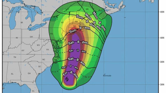
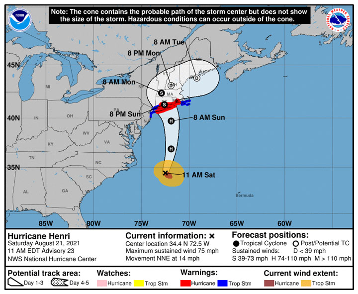
11 am Saturday…Henri is now a hurricane with maximum sustained winds of 75 mph.
Henri is located 645 mi south of Montauk Point NY and is moving to the north-northeast at 14 mph.
A faster northward to north-northeastward motion is expected today, followed by a decrease in forward speed and a turn toward the north-northwest on Sunday.
On the forecast track, Henri is expected to make landfall on Long Island or in southern New England on Sunday. Additional strengthening is forecast through tonight.
Although some weakening is expected prior to landfall on Sunday, Henri is forecast to be at or near hurricane strength when it reaches the coasts of Long Island and southern New England.
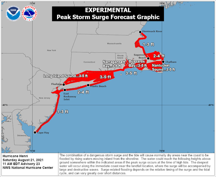
Dangerous storm surge inundation is expected to begin late tonight or Sunday in portions of Long Island, Connecticut, Rhode Island, and southeastern Massachusetts, where a Storm Surge Warning has been issued.
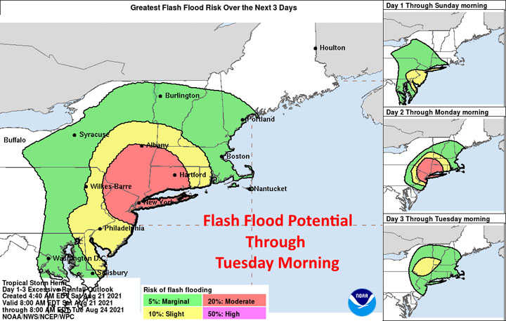
Dangerous storm surge is possible beginning late tonight or Sunday in western portions of Long Island and Connecticut in the Storm Surge Watch area. Residents in areas should follow any advice given by local officials.Hurricane conditions are expected to begin late tonight or Sunday in portions of Long Island, Connecticut, and Rhode Island, where a Hurricane Warning is in effect. Tropical storm conditions will begin in these areas tonight. Heavy rainfall may lead to considerable flash, urban, and small stream flooding, along with the potential for widespread minor and isolated moderate river flooding, over portions of Long Island, New England, southeast New York and northern New Jersey.


###
