Elmira, NY — Residents across the Twin Tiers are dealing with steady rainfall this week as multiple frontal boundaries push through the region. Forecasters say the systems will continue to bring showers into Friday before finally clearing out, paving the way for a sunny stretch that could last well into next week.
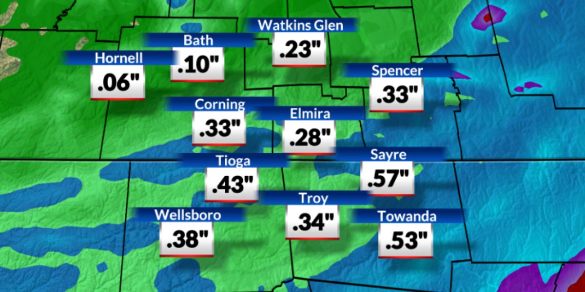
Rainfall Totals Before Clearing
Meteorologists estimate that by the time the skies begin to clear, the region will have seen more than an inch-and-a-half of rain. The soggy conditions have made for a wet midweek, but relief is on the horizon.
According to WETM’s forecast, once the current system departs Friday evening, a strong area of high pressure will dominate, bringing an extended period of dry weather.
High Pressure Brings Sunshine
Forecasters say the turnaround will be sharp.
“High pressure returns with reckless abandon next week. The rain that we have now will be a distant memory,” meteorologists noted.
That means partly-to-mostly sunny skies are expected across the region this weekend, with the dry pattern likely continuing through much of the upcoming week.
Temperatures on the Rise
Alongside the sunshine will come a noticeable warm-up. Temperatures across the Twin Tiers are projected to climb into the upper-70s, well above the seasonal average for early fall.
Key takeaways for residents include:
- Rain continues through Friday, with totals topping 1.5 inches.
- High pressure builds in by the weekend, ending the rainy streak.
- Partly-to-mostly sunny skies expected Saturday and Sunday.
- Temperatures will rise into the upper-70s next week.
- A new dry pattern may extend well beyond the weekend.
Outlook for the Twin Tiers
While residents may be weary of the wet weather, the good news is that sunshine and mild conditions are set to return quickly. The weekend offers a welcome break for outdoor plans, and the following week looks to remain calm, warm, and dry.
What are your plans once the sunshine returns to the Twin Tiers? Share your thoughts in the comments below.


