Staten Island, NY – As Hurricane Erin tracks offshore, forecasters are warning New Yorkers—especially those along the coast—to prepare for dangerous surf, coastal flooding, and erosion risks through late Friday.
High Surf Advisory in Effect
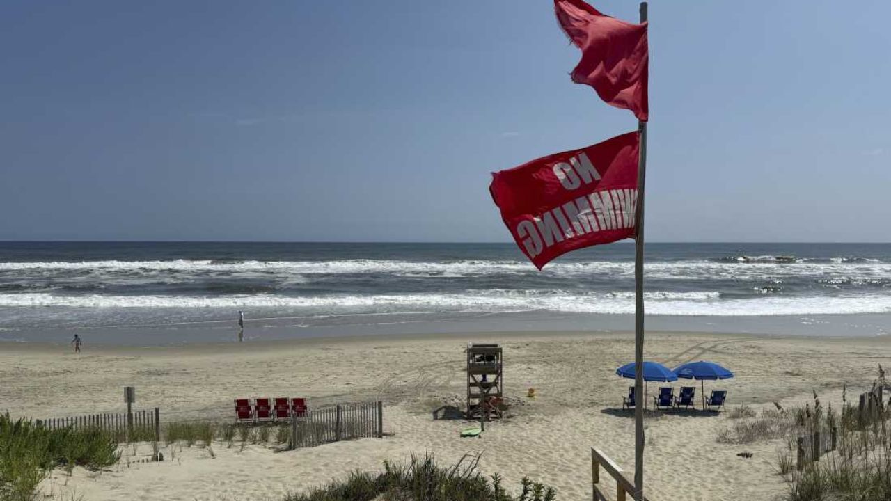
According to the National Weather Service (NWS), wave heights along Staten Island and nearby coastal areas could surge between 9 and 13 feet on Thursday night. A high surf advisory remains in place as the storm intensifies offshore, stirring up dangerous waves and increasing the threat of rip currents.
Winds are expected to strengthen throughout the day, with northeast gusts reaching up to 30 mph. These winds, paired with rising tides, are prompting concerns of moderate flooding in southern parts of the city.
Coastal Flooding Threats Begin Thursday Night
A coastal flood advisory was active from 8 p.m. Thursday to 1 a.m. Friday, particularly impacting Staten Island’s vulnerable shorelines. Emergency officials, per SiLive, are advising residents to stay clear of flood-prone areas and secure outdoor belongings.
Beachgoers and swimmers are urged to avoid entering the ocean waters through Friday evening. The NWS has classified rip current risk as high, making conditions potentially life-threatening even for experienced swimmers.
“Surf will remain hazardous through Friday morning,” the NWS stated. “Conditions will gradually improve by late Friday afternoon as Hurricane Erin moves away.”
Weekend Weather Looks Clear and Warm
Despite Thursday’s hazards, clear skies and calmer conditions are expected by the weekend. Temperatures will hover in the low-to-mid 80s, with sunshine dominating Saturday and Sunday as high pressure builds behind Erin.
Once the hurricane shifts further east, New York City’s weather pattern will stabilize, with no additional storms forecasted at this time.
Emergency Guidance and Safety Precautions
Residents are encouraged to:
- Stay informed by monitoring real-time updates from the National Weather Service or NYC Emergency Management.
- Avoid walking or driving through flooded streets, as water may be deeper or more hazardous than it appears.
- Refrain from coastal activities until rip current risks have subsided.
- Follow any local advisories or evacuation notices if flooding becomes severe.
What do you think of this storm update? Share your thoughts in the comments, and stay prepared.


