Los Angeles, CA – Southern California is bracing for a familiar winter weather cycle this week, as sunny skies and powerful Santa Ana winds take hold before giving way to a renewed chance of rain around the New Year, according to meteorologist.
Forecasters say residents should prepare for strong wind gusts, potential power disruptions, and changing conditions that could impact travel and outdoor plans as 2025 approaches.
Sunny Start Followed by Intensifying Santa Ana Winds
Weather conditions across Southern California will remain mostly calm through Sunday and Monday, with plenty of sunshine and mild daytime temperatures. However, that tranquility won’t last long.
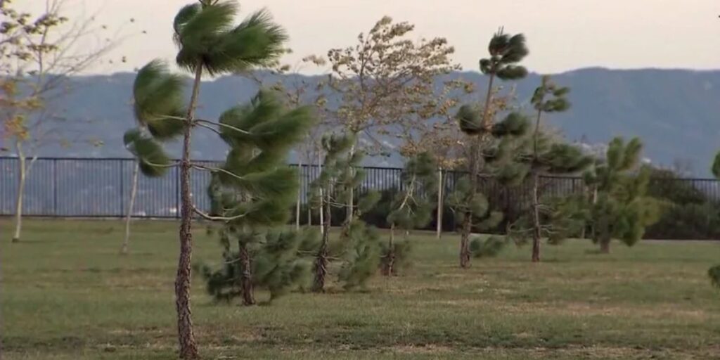
According to Montoya, Santa Ana winds are expected to strengthen by Sunday afternoon and evening, with the most intense gusts developing overnight into Monday morning. Wind speeds in typical Santa Ana wind-prone areas could reach 45 to 50 miles per hour.
The strongest winds are forecast for mountain passes, interior valleys, and desert-facing communities, where Santa Ana events tend to funnel and intensify.
Wind Advisory and High Wind Watch Issued
The National Weather Service has issued a wind advisory effective from 6 p.m. to 10 p.m. Sunday, signaling potentially hazardous conditions for drivers and outdoor activities.
Following that, the advisory will transition into a high wind watch beginning at 10 p.m. Sunday, covering a broad region that includes:
- The I-5 Corridor
- The Highway 14 Corridor
- Mountain regions
- The Inland Empire
- Parts of Orange County
Gusty conditions are expected to persist for several days, with winds finally beginning to ease by Tuesday, forecasters say.
Increased Risk of Downed Trees and Power Lines
Montoya emphasized that the recent storms have left the ground saturated, raising concerns about downed trees and fallen power lines during periods of strong wind.
“When soils are already wet, it doesn’t take much for trees to come down,” Montoya warned, particularly in areas that regularly experience Santa Ana wind events.
Residents in high-risk zones are urged to remain alert for road closures, power outages, and falling debris, especially during overnight and early morning hours when winds are strongest.
Clouds Build Ahead of the Next Storm System
Despite the gusty conditions, skies across much of Southern California are expected to remain mostly sunny through Monday. That will change as the week progresses.
By Tuesday, cloud cover will begin increasing, signaling the arrival of the next Pacific storm system. Meteorologists say this system has the potential to bring widespread rainfall just in time for holiday celebrations.
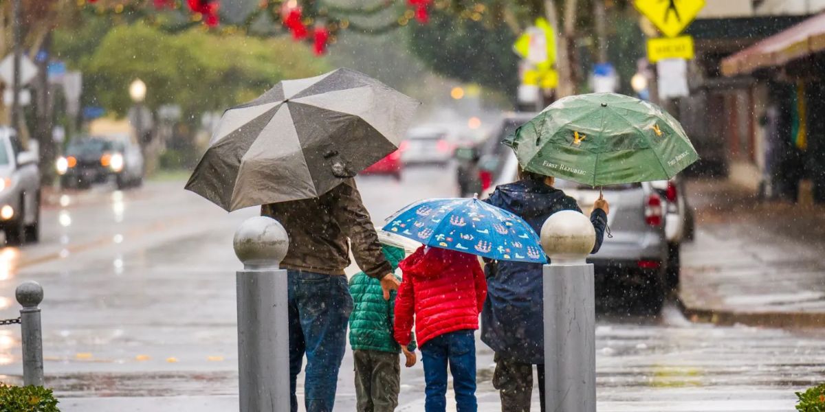
Rain Likely Around New Year’s Day
Forecast models indicate a strong chance of rain developing late Wednesday, with widespread showers likely on New Year’s Day. While rainfall totals remain uncertain, Montoya said the pattern suggests a multi-day wet stretch.
Rain could continue into Friday, Saturday, and possibly Sunday, depending on how the storm system evolves. Forecasters caution that timing and intensity may change as newer data becomes available.
If the rain materializes as expected, it could further impact already saturated areas, increasing the risk of localized flooding and slick roadways.
Residents Urged to Prepare Now
Officials are encouraging residents to take proactive steps ahead of the windy and wet conditions. Recommended safety measures include:
- Securing loose outdoor items, such as patio furniture and trash bins
- Avoiding parking under trees or power lines
- Driving cautiously during high wind periods
- Preparing for rainy conditions and potential travel delays later in the week
With a combination of high winds and incoming rain, this week’s weather serves as a reminder of Southern California’s dynamic winter climate.
How are you preparing for the Santa Ana winds and possible New Year’s rain in Southern California? Do you welcome the wet weather, or are you concerned about its impacts? Share your thoughts in the comments below and be part of the discussion.


