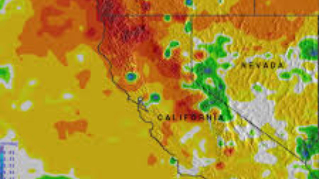
Humboldt County, California – Deep in Northern California’s rugged King Range, meteorologists have identified a remote stretch of terrain that has absorbed an extraordinary amount of rainfall this season, with totals so high they are now measured in feet rather than inches. According to SFGATE, one monitoring site near the small town of Honeydew has already recorded more than 73 inches of rain since the start of the water year.
Rainfall Far Exceeds Seasonal Averages
The monitoring site near Honeydew, located in Humboldt County, has logged 73.2 inches of rainfall since Oct. 1, marking an unusually wet start to the water year. Meteorologist Jacob Boomsma with the National Weather Service’s Eureka office said the total places the area at about 140% of its typical rainfall for this point in the season.
Under normal conditions, the Honeydew area receives an average of 52 inches of rain by mid-January. This year’s storm activity has pushed totals far beyond that benchmark, making it one of the wettest locations in Northern California so far this season.
Remote Terrain Faces Landslide Risks
Because the King Range is sparsely populated and difficult to access, heavy rainfall can create challenges for residents. Only a few roads serve the region, and intense rain can trigger landslides that temporarily isolate communities.
“It’s a pretty remote area, so there’s only a few roads that service it,” Boomsma said. “With that much rain, there can be landslides that cut people off for a little bit.”
Despite the risks, residents are accustomed to the conditions. Many are described as self-sufficient and aware of the possibility of isolation during especially wet winters.
Topography Plays a Major Role in Extreme Rainfall
Meteorologists attribute the unusually high rainfall to the King Range’s unique geography. The mountain range juts westward toward the Pacific Ocean, making it especially vulnerable to moisture-heavy storm systems.
“When you get those southerly winds with each cold front, it’ll just hit the King Range,” Boomsma explained. “We call it orographic lift, where the precipitation enhances in that area.”
This effect causes moist air to rise rapidly when it encounters steep terrain, cooling and releasing large amounts of precipitation in a short time.
Atmospheric Rivers Fueled the Wet Season
At least two long-lasting atmospheric rivers earlier this winter significantly contributed to the rainfall totals. These storm systems lingered over the King Range and nearby areas, delivering steady, prolonged rain rather than brief downpours.
According to Boomsma, the region is experiencing conditions that are wetter than normal, though not unprecedented for such a storm-prone area.
“It’s just a little bit extra wetter than usual,” he said.
Rest of Northern California Turns Dry
While the King Range continues to stand out for extreme rainfall, much of Northern California has entered a drier phase following weeks of storms. A high-pressure system along the West Coast is keeping conditions mostly dry and warmer than average for mid-January.
Weather forecasts for the Bay Area indicate chilly mornings, lingering valley fog, and little to no rain in the coming days, offering a sharp contrast to the soaking conditions along the remote Humboldt County coastline.


