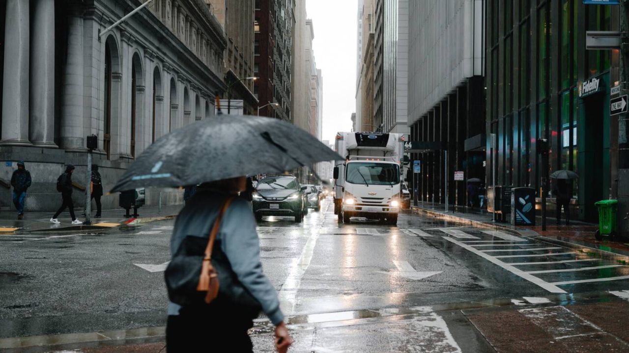
San Francisco, California — After weeks of dry skies and stagnant air, rain is finally returning to the Bay Area and Central Coast, marking the start of a strengthening storm pattern that forecasters say could last through Christmas week. Light showers began moving into Northern California on Tuesday, offering the first measurable rainfall many communities have seen in nearly a month.
According to the National Weather Service, the early system is modest, but it signals a major shift in the region’s weather pattern following one of the driest Decembers in decades.
Light rain arrives, heavier systems ahead
Meteorologists said light showers spread into the North Bay early Tuesday, with rainfall totals remaining limited at first. The North Bay could see up to a quarter inch, while areas along the Peninsula and East Bay shoreline may receive less than a tenth of an inch. The South Bay and Central Coast were expected to see only spotty drizzle or remain mostly dry during the initial phase.
Forecasters emphasized that this system is just the beginning.
“The overall message is that we’re transitioning into a much wetter pattern that looks to last at least through Christmas,” the Weather Service said.
A second weak cold front is forecast to arrive Wednesday, keeping skies gray and producing light rain or drizzle in some coastal areas. The main weather impacts, however, are expected later in the week as the Pacific storm track shifts southward.
Storm door opens late week
By Thursday, a strong upper-level trough over the Pacific is expected to open what forecasters describe as the ‘storm door’, allowing a steady stream of moisture to flow into Northern California. Widespread rain is forecast to begin Friday and continue through the weekend, with coverage expanding from north to south.
The heaviest rainfall is expected in the North Bay, while rain is forecast to spread into the Central Coast by Saturday. Forecasters say confidence is increasing that multiple storm systems will affect the region into early next week.
Rainfall totals could be significant
Projected rainfall totals through Monday show a notable change from the dry pattern that has dominated December:
- Up to 5 inches in the coastal hills of the North Bay
- 1.5 to 4 inches across inland North Bay areas
- 0.5 to 1.5 inches around the central Bay Area
- Up to 1.5 inches along the Central Coast
Winds may also strengthen late Sunday into early next week as another system develops offshore, raising the potential for travel disruptions during the holiday period.
December dryness sets records
The incoming rain follows an exceptionally dry stretch. The Bay Area and Central Coast have gone nearly a month without measurable rainfall, and several cities are experiencing their driest December in decades.
According to local meteorologists, this December is the driest since 1989 in Napa, Oakland, Salinas, San Francisco, and Santa Rosa. Monterey has not seen conditions this dry since 1976, while Half Moon Bay hasn’t experienced a similar lack of rain since 1979.
The prolonged dryness has been caused by a persistent high-pressure ridge over California, which deflected storms north into the Pacific Northwest, where historic flooding has occurred.
Air quality expected to improve
The same high-pressure system that blocked storms also trapped fog and pollution near the surface, leading to unhealthy air quality in parts of the region. Forecasters say the incoming storms should help clear out stagnant air, improving visibility and lifting persistent fog.
Rain and increased wind will help break the inversion that has kept pollution concentrated over urban areas, offering some relief after weeks of hazy conditions.
Wet pattern may last through late December
Looking ahead, the National Weather Service said confidence is growing that the wet pattern could persist through the end of December, with a moderate chance that additional storms could arrive after Christmas.
“Now is a good time to get ready,” forecasters said, urging residents to take precautions ahead of the more active weather.
Officials recommend clearing leaves from gutters, checking storm drains, and securing outdoor decorations or holiday inflatables before gustier conditions arrive. Travelers, especially those heading through mountain passes, are advised to monitor forecasts closely due to the potential for heavy rain or snow.
As California shifts back into a wetter rhythm, residents are being reminded that preparation now could help minimize disruptions later in the holiday season.
Do you think this wet pattern will stick around through the end of the year? Share your thoughts in the comments.


