Twin Cities, MN — Weather officials late Sunday issued warnings of “significant/life-threatening” flooding as storms delivering heavy, sustained rain moved across the southern third of Minnesota. Authorities are urging residents to exercise caution as flash flooding and severe weather are expected overnight.
Flood Watches Issued Across the Region
The National Weather Service (NWS) has issued a flood watch covering:
- Western, central, and southern Minnesota from 7 p.m. Sunday to 7 a.m. Monday
- Twin Cities, southeastern Minnesota, and western Wisconsin from 10 p.m. Sunday to 10 a.m. Monday
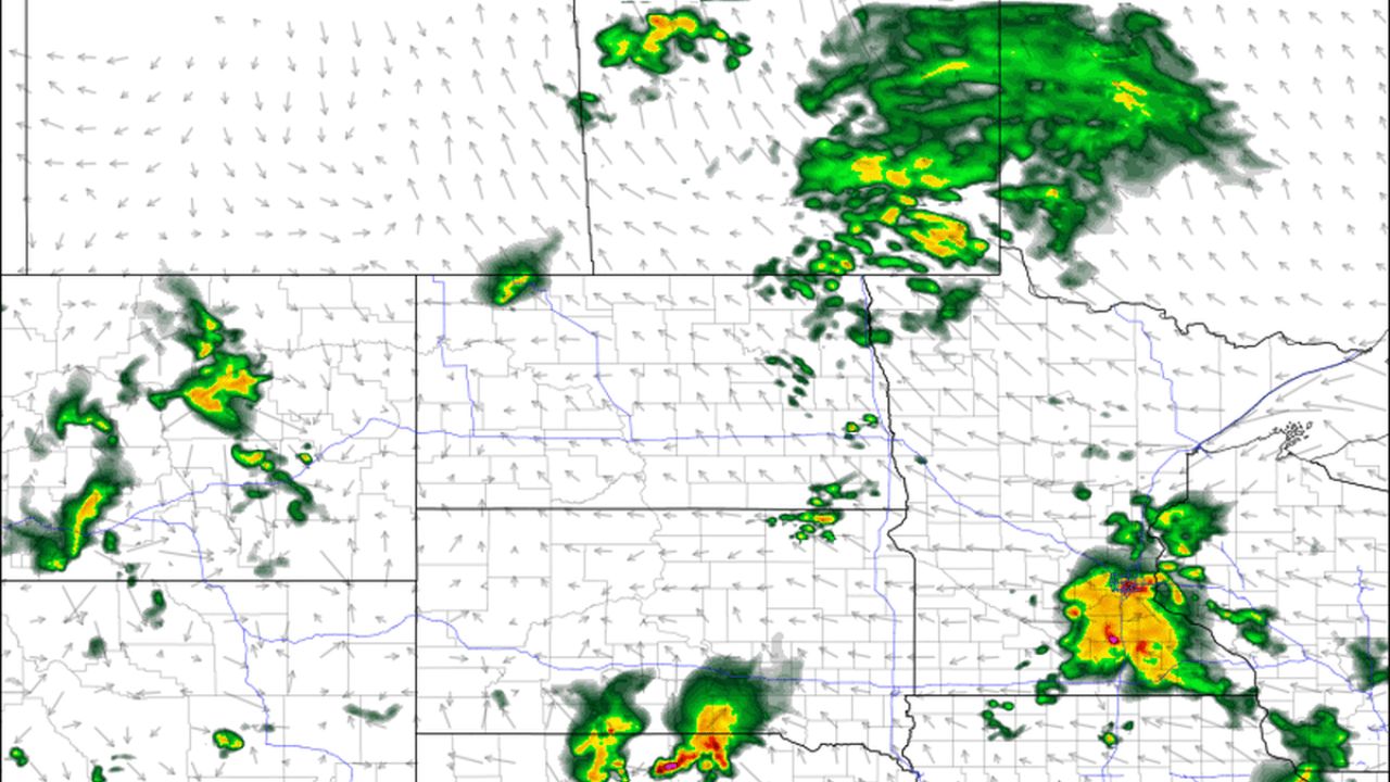
Forecasters are expecting 1–2 inches of rainfall, with localized amounts of 4 inches or more possible. In addition, severe thunderstorms and tornado threats are also present.
“1-3 inches per hour rainfall rates are expected to continue into the overnight, resulting in localized short-term totals as high as 4-8 inches,”
— National Weather Service, Mesoscale Precipitation Discussion
The highest risk zone includes much of the Twin Cities, covering Hennepin, Ramsey, Dakota, Scott, Carver, Washington, and parts of Anoka County.
Flash Flood Warnings and Urban Flooding
Several flash flood warnings are in effect:
- Faribault, Red Wing, and Cannon Falls until 2:30 a.m.
- Owatonna, Blooming Prairie, and Waseca until 2:30 a.m.
The NWS warns that the seven-county Twin Cities metro may experience urban and small stream flooding until midnight.
“A slow-moving line of thunderstorms is producing heavy rainfall rates of around 2 inches per hour as it moves northeastward across the region,”
— National Weather Service, Twin Cities
“Localized flooding may occur, especially in low-lying areas. Avoid driving or walking into flooded areas.”
Severe Thunderstorm Threats
The NWS has also issued severe thunderstorm warnings for parts of the Twin Cities metro, including Prior Lake, Savage, Eden Prairie, Minnetonka, and Edina, with wind gusts up to 60 mph and pea-sized hail possible.
“The storm system currently over the Twin Cities could hang around until past midnight, dropping more rain on the metro area,”
— AccuWeather forecast
Meteorologists predict that additional storm cells could develop in central Minnesota around 3 a.m., with a larger system entering southwestern Minnesota by 4 a.m. and reaching the Twin Cities by about 8 a.m. Monday.
Precautionary Advice for Residents
Officials recommend the following precautions:
- Avoid driving or walking into flooded areas
- Monitor local weather alerts for updates on flood and severe weather warnings
“Flood watch is in effect overnight — the ground is saturated. There is potential for serious flash flooding overnight,”
— Paul Douglas, Minnesota Meteorologist
Authorities urge residents to stay indoors if possible and report flooding hazards to local officials.
What precautions are you taking to stay safe during the heavy rains? Share your thoughts in the comments.


