Philadelphia, PA — A fresh surge of bone-chilling air from the Polar Vortex could sweep into the central and northeastern United States this weekend, potentially triggering the first significant snowstorm of the season along the Interstate 95 corridor.
Meteorologists caution, however, that uncertainty remains high, and residents should continue monitoring updates as the week progresses.
Forecast Models Point to Snow Moving East
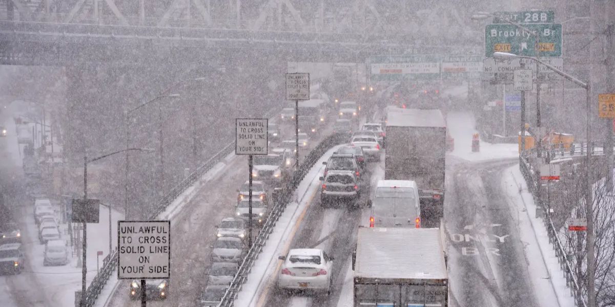
According to the FOX Forecast Center, current computer models indicate snow will move into the Midwest on Saturday, with the Northeast expected to see snowfall by Sunday. This storm system is being closely watched as forecasters assess the potential for heavy snow accumulation, particularly in major metro areas including Boston, Philadelphia, and New York City.
The timing and intensity of the storm remain uncertain because several factors must align to produce significant snowfall. Forecasters warn that if one component is missing, snow totals could be considerably lower than projected.
Weakening Polar Vortex Brings Frigid Air
The Polar Vortex—a large, persistent low-pressure system near the North Pole located 10–30 miles above Earth’s surface—is expected to weaken later this week. When strong, the Polar Vortex keeps the coldest air locked over the Arctic, but a weakened vortex allows frigid air to spill south into the Midwest and Northeast, ushered along by dips in the Pacific jet stream.
This pattern follows a week of record low temperatures in New England set earlier this week. Experts note that the approaching cold air will create ideal conditions for snow if combined with a storm system bringing sufficient moisture from the south.
Potential for a Coastal Low
If the cold air interacts with a fast-moving storm system from the Pacific Northwest and receives enough moisture from the south, meteorologists say a coastal low-pressure system could develop. This setup would greatly enhance the chance of heavy snowfall along the I-95 corridor, marking the first major snow event of the season for cities in the Northeast U.S.
However, forecasters emphasize that small changes in timing, temperature, or moisture availability could drastically affect snow totals and storm intensity.
La Niña and Winter Outlook
The potential storm aligns with the NOAA long-range outlook released last month, which predicted an active start to meteorological winter. Meteorologists cite the La Niña climate pattern as a contributing factor to increased volatility in winter weather, with more frequent bursts of cold air and higher chances for early-season storms.
Residents in affected areas are advised to prepare for rapidly changing conditions, especially during weekend travel, and to stay updated through local weather alerts.
Are you ready for winter’s first big snowstorm along the I-95 corridor? How are you preparing for the potential snow and frigid temperatures?
Share your plans and concerns in the comments below!


