Orlando, Florida — Central Florida is gearing up for a stretch of sunny skies, mild warmth, and a nearly rain-free weekend — but early-morning fog may throw a small curveball for drivers heading out before sunrise.
Sunny Skies Dominate the Weekend Forecast
Residents across Orlando and the surrounding region can expect a pair of picture-perfect afternoons as temperatures climb into the low 80s through Saturday and Sunday. According to local meteorologists, a broad zone of high pressure sitting over the Sunshine State is keeping conditions unusually calm and allowing the warm, dry spell to settle in for several days.
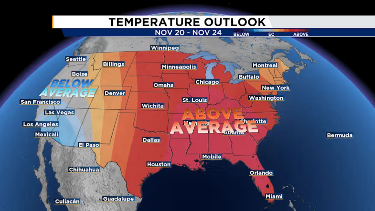
This mellow weather pattern isn’t fading anytime soon. Forecast models show the same setup persisting well into next week, setting the stage for a Thanksgiving stretch that could feel more like early fall than late November. In fact, much of the Southeast and Midwest are also expected to run warmer than average, making this not just a local warmup but a regional trend.
Morning Fog May Create Travel Hazards
While afternoons look tailor-made for outdoor plans, mornings may tell a different story. Thick, patchy fog is expected to form early Saturday and Sunday, especially in low-lying or residential pockets known for trapping moisture. Visibility could drop suddenly, turning early-morning commutes into a cautious crawl.
Drivers heading out before sunrise are urged to use headlights and keep speeds down — and maybe bring a light jacket. Some locations north and west of I-4 could slip into the upper 40s or low 50s before daytime heating kicks in.
The fog should gradually lift by mid-morning once the sun takes over, revealing the clear skies and comfortable temperatures forecast for the rest of the day, as per the forecast by ClickOrlando.
Dry Streak Raises Drought Concerns
While the sunshine is a weekend mood-booster, it comes with a downside: Central Florida’s expanding drought conditions. Several counties across the region are already experiencing abnormally dry weather, and pockets of moderate drought have emerged in Marion, Lake, and Sumter counties.
With no meaningful rainfall in the immediate forecast, meteorologists warn these dry zones could grow. The continued absence of moisture weakens soil, stresses vegetation, and increases fire danger — all typical risks during prolonged dry spells in late fall.
Residents planning outdoor burns or fire-related activities are encouraged to check local advisories and take precautions as conditions evolve.
No Tropical Activity Expected Anytime Soon
For those keeping an eye on the tropics — especially with the tail end of hurricane season still officially underway — the outlook remains quiet. The National Hurricane Center, along with the Pinpoint Weather Team, reports no active systems or threats expected to form over the next several days.
This calm window offers Central Floridians some peace of mind heading into the busy holiday travel period.
Warm Week Ahead — Time to Swap Sweaters for Shades
With afternoon highs lingering in the 80s and humidity slowly inching upward, this upcoming week may feel more like a preview of spring than Thanksgiving season. Light layers, sun protection, and plenty of hydration will go a long way for anyone enjoying the pleasant outdoor conditions.
And if you’re a fan of warm weather, you’re in luck — this sunshine streak looks set to last.
What’s the weather like in your neighborhood today? Foggy sunrise? Bright blue skies? Drop your photos, thoughts, or weather vibes in the comments below! Let’s make this a community forecast.


