Orlando, FL – Central Florida residents should prepare for a noticeable drop in temperatures as a strong cold front moves through the region, just in time for New Year’s Eve, according to the National Weather Service. The shift comes after a period of unseasonably warm weather, providing a stark contrast to recent highs.
Warm Weather Continues Through Friday
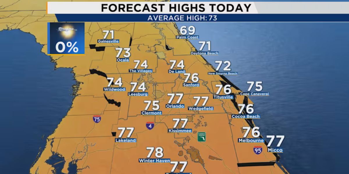
Before the arrival of the cold front, temperatures are expected to remain above average, with Friday’s highs reaching the upper 70s to lower 80s across much of Central Florida. Residents can enjoy mainly sunny skies with little to no rainfall expected through the weekend. Overnight conditions will remain mostly clear, allowing for pleasant evenings.
Foggy Mornings and Breezy Coastal Conditions
Meteorologists are warning early risers to be prepared for patchy fog, particularly on Saturday and Sunday mornings. Visibility may be reduced in some areas, so travelers are advised to allow extra time when heading out before sunrise.
Coastal areas are also expected to experience breezy conditions, with wind gusts forecast between 10 and 15 mph. Inland locations will likely be less affected by the wind. The combination of dry air, a high-pressure system to the west, and breezy weather means rain chances remain very low over the weekend.
Strong Cold Front to Bring Cooler Temperatures
Looking ahead to next week, the cold front will usher in a significant cooldown, with daytime highs dropping below previous levels. Daytime temperatures are forecast to remain near 80 degrees through Monday, but overnight lows will see a more dramatic drop. By midweek, temperatures are expected to fall into the low 40s in some areas, marking one of the first substantial cool spells of the season.
Forecasters note that skies will remain mostly sunny, and very limited rainfall is expected throughout the period, making for comfortable but cooler conditions as residents welcome the New Year.
Preparing for the Temperature Shift

Local authorities and meteorologists advise residents to prepare for the cooler weather, especially for outdoor New Year’s Eve celebrations. Light jackets or layers are recommended for evening and overnight activities. While the cold front will bring relief from the unseasonably warm days, the temperature contrast may feel abrupt to those accustomed to recent highs.
The forecast indicates a smooth transition in weather conditions, with the front bringing a stable high-pressure system and minimal precipitation. This means sunny, crisp days with cooler nights for Central Florida residents as they head into the first week of 2026.
Are you ready for the New Year’s Eve cooldown? Share how you plan to adjust your plans or wardrobe in the comments below. Your tips can help fellow residents prepare for the chilly shift!


