Albuquerque, NM — A significant weather system is pushing into New Mexico overnight, bringing widespread rain, thunderstorms, and substantial mountain snowfall across multiple regions of the state. Scattered showers that developed earlier on Wednesday are expected to intensify, setting the stage for a wet and wintry transition for thousands of residents.
Forecasters report that a concentrated band of heavier rain and high-elevation snow will sweep from southwest New Mexico into the central portion of the state overnight. Snow levels will drop to around 8,000’ to 9,000’, where temperatures are cold enough to support accumulation.
Where Snowfall Will Be Heaviest
The northern mountains and the San Juan Mountains in southern Colorado are under Winter Weather Advisories starting tonight. These areas could see 3″ to 8″ of snow, with the tallest peaks potentially reaching 10 inches.
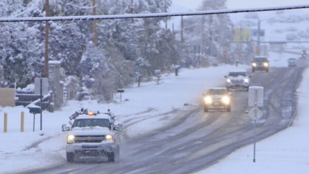
Road conditions in high-elevation areas may deteriorate rapidly, especially during the early morning hours on Thursday as moisture deepens over the region. Drivers traveling through mountainous terrain are urged to use caution.
Storm Intensifies for Thursday Morning Commute
As the storm moves eastward, Thursday morning will bring widespread showers to the eastern half of New Mexico. This includes pockets of briefly heavy rain and bursts of heavy snow above 9,000 feet, raising concerns for slippery roads, reduced visibility, and slow-moving traffic during peak commuter hours.
Meanwhile, additional showers and mountain snow will continue to develop across the rest of the state throughout the day. Thunderstorms may form sporadically, adding to the wet and unsettled conditions.
Clearing Skies Arrive by Evening
By Thursday afternoon, southern New Mexico will begin to see gradual clearing as dry air nudges in from the southwest. Weather conditions will continue to improve throughout the evening, eventually spreading northward.
However, light mountain snow is expected to linger across the northern mountains into early Friday morning, keeping travel conditions in those areas unpredictable.
Cooler Temperatures Behind the Storm
In the wake of this system, the entire state will experience much cooler air, with daytime highs and overnight lows dropping to near or below average for mid-November. Residents should expect chilly mornings and brisk afternoons heading into the weekend.
Another Round of Rain and Snow Expected This Weekend
The break in active weather will be short-lived. Saturday will bring a brief warm-up, but moisture will return that same day as yet another storm system approaches from the west.
Southwest New Mexico is forecast to see the first round of rain and mountain snow, which will expand statewide on Sunday. More high-elevation snow is likely, continuing an early-season trend of wet and wintry conditions.
This weekend storm is expected to push out by early Monday morning, leaving behind drier and cooler weather for the start of next week.
How is the incoming rain and snow affecting your plans? Share your thoughts, photos, or local conditions in the comments below — your updates help keep the community informed!


