Chicago, Ill. – Most of the middle and eastern portions of the United States are bracing for a powerful winter storm expected to impact as many as 150 million people, with heavy snow, dangerous wind chills, and severe travel disruptions forecast over the coming days. According to the National Weather Service, a separate but urgent winter system is already unfolding across parts of the Great Lakes and Upper Midwest, prompting warnings in a dozen states.
Great Lakes Region Braces for Heavy Snowfall
Forecasters say shortwave energy rotating around a large upper-level low over Hudson Bay will push two low-pressure systems through the Great Lakes region. This setup is expected to produce 6 to 12 inches of snow, with locally higher totals.
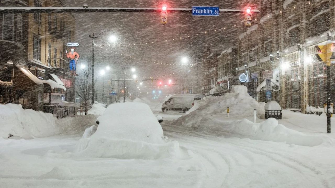
Areas downwind of Lake Ontario face the most extreme conditions, where lake-effect snow could exceed two feet by Friday morning. Meteorologists say this type of snow can be highly localized, creating sudden whiteout conditions over short distances.
In total, 12 states are under winter weather warnings, including North Dakota, South Dakota, Minnesota, Iowa, Wisconsin, Illinois, Indiana, Michigan, Ohio, Kentucky, Pennsylvania, and New York. Officials say Michigan and New York are likely to experience the most severe impacts.
Travel Warnings Issued in Michigan and New York
The NWS has urged residents to avoid unnecessary travel, particularly in snowbelt regions.
“If you must travel, keep an extra flashlight, food, and water in your vehicle in case of an emergency,” the agency warned, noting that lake-effect snow can cause rapidly changing visibility and road conditions.
In New York, areas east of Lakes Erie and Ontario are expected to see an additional 2 to 4 inches of snow by daybreak, with forecasters warning that another 30 inches could fall through Friday in persistent lake-effect bands affecting Jefferson and northern Lewis counties.
Dangerous Wind Chills and Arctic Air Incoming
Beyond snowfall, the National Weather Service is warning of life-threatening cold as Arctic air spreads south and east.
“Frigid sub-zero and single-digit temperatures will expand from the Northern Plains into the Ohio Valley and Northeast by Sunday,” the agency said. “The coldest wind chills may fall below -50 degrees across the Northern Plains.”
Extreme cold warnings, watches, and advisories are already in effect for parts of the Northern Plains and Upper Midwest, with gusty winds expected to worsen frostbite risk.
Preparing for Severe Winter Conditions
Officials stress that preparation is critical as the storm unfolds. Winter weather warnings advise residents to stock emergency supplies, protect vehicles, and secure homes against freezing temperatures.
Cold-weather preparedness guides, including advice on winterizing garages, pipes, and sprinkler systems, have been highlighted by Men’s Journal, which notes that proper preparation can help prevent costly damage during prolonged freezes.
Meteorologists caution that conditions may evolve rapidly over the next several days, urging residents to monitor forecasts closely and heed local advisories as the storm system intensifies.