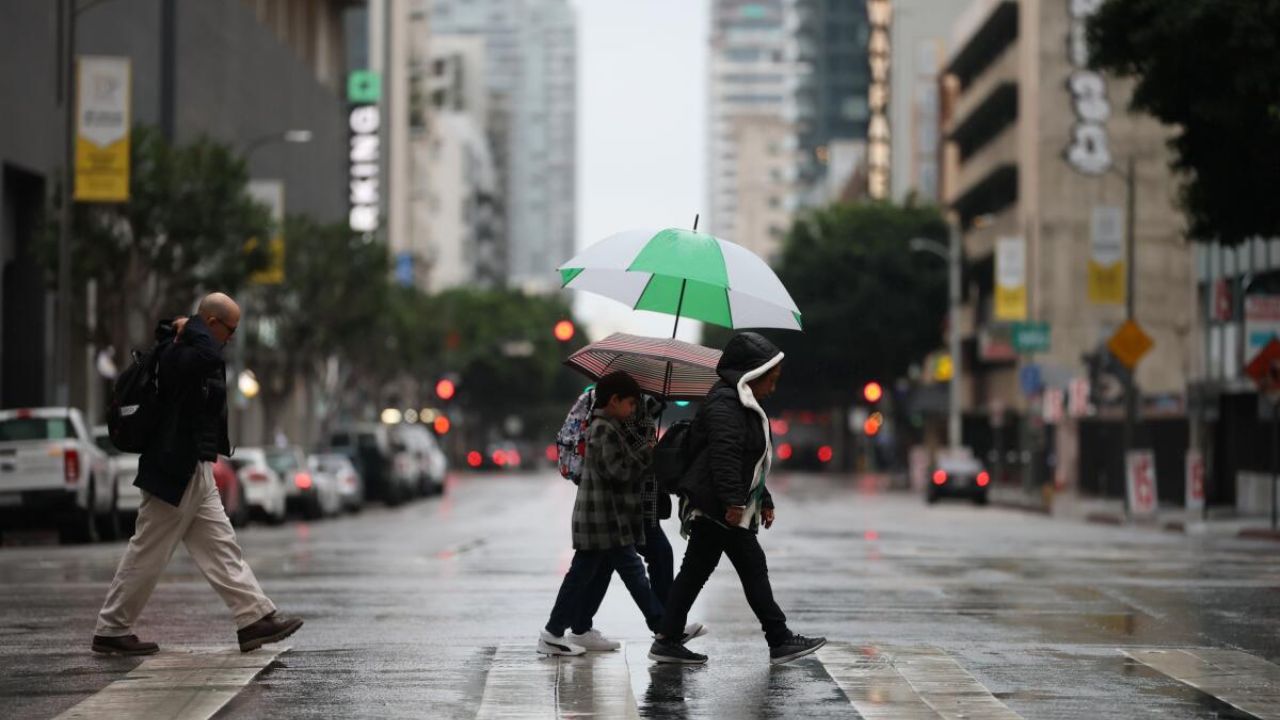
Los Angeles, California — After enduring a powerful atmospheric river on Saturday, Southern California is catching only a short breather before the next storm system sweeps in. Forecasters with the National Weather Service (NWS) said Sunday that another round of rain is expected to arrive by Monday morning, bringing several more hours of wet weather to the region.
The weekend’s storm soaked nearly every county in the Southland, leaving behind widespread flooding concerns, slick roads and saturated hillsides — and the upcoming system is expected to add even more moisture to already drenched ground.
Rain Totals Reveal Widespread 2–5 Inches Across the Region
Updated rainfall data released by the NWS on Sunday showed significant totals across Los Angeles, Ventura, Orange, San Bernardino and Riverside counties over the last 48 hours. Many foothill and valley communities recorded 2–4 inches, while several mountain locations saw much higher numbers.
Some of the largest weekend totals included:
- 5.52 inches – Mount Baldy
- 4.96 inches – Camarillo
- 4.93 inches – Ojai
- 4.80 inches – Santa Anita Dam
- 4.69 inches – San Gabriel Dam
Meteorologist Kacey Montoya (KTLA) reported that Sunday’s scattered showers would be far lighter than the intense downpours that hit the region on Saturday, but she warned that rain would continue through early afternoon in areas including Malibu, Ventura County, the San Fernando Valley, Orange County, and parts of the Inland Empire.
“We’ll get a break tonight,” Montoya said, “before the next system moves in tomorrow. It’s colder, and it will bring significant rain — but not as much as what we saw yesterday.”
More Rain Expected Monday as New System Arrives
The next storm system is forecast to roll in early Monday, bringing a sustained period of moderate to heavy rainfall across the Los Angeles Basin, Ventura County, Orange County, and the Inland Empire. Forecasters say rainfall rates could reach ½ inch per hour, enough to cause minor flooding in areas with poor drainage.
As of Sunday afternoon, no evacuation orders or warnings had been issued for the upcoming weather.
Montoya noted that different weather models disagree on the exact start time, but all agree on one thing — once the rain begins, it will persist for several hours.

Areas in Los Angeles and Ventura counties will likely see the first wave before the storm shifts east toward mountain and desert regions by late afternoon. Scattered showers may linger into Tuesday morning, with conditions expected to dry out by Wednesday.
Most coastal and valley communities may see an additional 0.5 to 0.75 inches of rain from Sunday night through Monday night.
Snow, Fog and Hazardous Mountain Travel Expected
Higher elevations will continue to see winter weather complications. Erin Myers (KTLA) reported dense fog, slushy surfaces and debris on Highway 18 and Old Waterman Canyon Road early Sunday morning.
Temperatures plummeted overnight Saturday, producing 2.5 inches of new snow above 6,500 feet. With colder air arriving Monday, snow levels are expected to shift:
- Above 7,000 ft on Monday
- 5,000–6,000 ft by Monday night
- Around 4,500 ft on Tuesday
The NWS estimates 1–3 inches of snow above 6,000 feet. Chains may be required in some areas, and Caltrans urges drivers to carry blankets, flashlights, chargers and emergency supplies.
Saturated Ground and Strong Winds Raise Risk of Falling Trees
Montoya also warned about strong winds — 30–35 mph gusts in mountain and desert areas — paired with waterlogged soil, potentially leading to downed trees or power lines through Sunday evening.
Coastal regions remain under Small Craft Advisories through midweek due to rough seas and the possibility of isolated offshore thunderstorms.
Another Rain Chance Later This Week
While Southern California should finally dry out briefly on Wednesday, another system could approach by Friday, bringing the chance for additional showers.
Officials encourage residents to stay updated on forecasts and monitor road conditions, especially in areas vulnerable to rockslides, mudflows, and debris.
Southern California is getting hit storm after storm — are you ready for another wet week?
Share your thoughts, storm prep tips, or neighborhood updates in the comments below!


