Kansas City, MO – A large cold front is expected to move across Missouri late this week into the weekend, bringing showers, thunderstorms, and a return to cooler fall-like conditions. Residents should prepare for potentially gusty winds, hail, and isolated severe storms, especially in Kansas City and St. Louis.
Cold Front Brings End of Summer-Like Weather
The Show-Me State has experienced summer-like warmth, but that is expected to change as a cold front sweeps through Friday and Saturday. The front will bring:
- Widespread rainfall across the state
- Cooler air following the frontal passage
- A noticeable drop in temperatures for most areas
Forecasters note that the severe weather threat is conditional, meaning storms could develop if enough sunlight and daytime heating occur. However, early cloud cover or rain could limit storm potential.
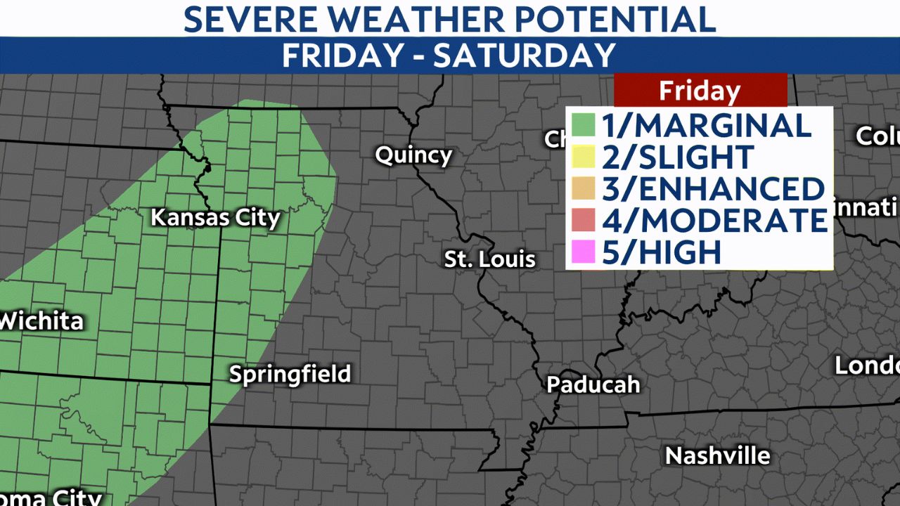
Kansas City: Isolated Severe Storms Possible
The Storm Prediction Center has placed Kansas City at a level 1/5 risk for severe weather Friday evening into the overnight hours.
- Main threats: Gusty winds and hail
- Timing: Afternoon and early evening for initial showers; bulk of precipitation after dark
- Impact on outdoor events: Garmin Kansas City Marathon participants should monitor radar and be prepared for possible wet conditions
Forecasters say daytime heating could produce a few showers or isolated thunderstorms ahead of the front. If conditions allow, one or more of these storms could briefly reach severe levels. Overnight showers and thunderstorms may also continue, with isolated severe storms possible before the system moves east.
St. Louis: Storm Threat Increases Saturday
In St. Louis, the severe threat increases Saturday as the front progresses across eastern Missouri. Forecasters caution that the threat remains conditional, depending on how cloudy or wet the morning is:
- Morning rain: Could limit severe potential if widespread
- Afternoon storms: If skies clear, thunderstorms along the front could become strong to severe
- Main risks: Gusty winds, hail, and a quick spin-up tornado
Participants in The Great GO! St. Louis Halloween Race should check updates and plan for possible wet and windy conditions, especially in Eureka.
Cooler and Drier Weather Arrives Sunday
By Sunday, the cold front will bring cooler, drier air, signaling a true start to fall weather:
- Highs: Low to mid-60s
- Winds: Breezy after frontal passage, making it feel cooler
- Sky conditions: Mostly sunny skies returning
Residents can expect more comfortable fall temperatures after several days of unsettled weather, providing a respite for outdoor activities and events.
Safety Tips for Stormy Weather
With the potential for isolated severe storms this weekend, safety experts recommend:
- Stay updated on radar and weather alerts from the National Weather Service
- Secure outdoor items such as patio furniture and decorations in gusty winds
- Avoid driving through flooded areas or streets with heavy rain
- Move indoors during thunderstorms and avoid windows
- Check conditions before races or outdoor events to plan safely
Missourians are reminded that while the storm threat is low to moderate, the unsettled weather could impact travel and outdoor plans, particularly on Friday evening and Saturday.
Are you planning to be outdoors this weekend in Missouri? Share your weather plans and how you’re preparing in the comments below.


