Outer Banks, NC — Hurricane Erin, the first Atlantic hurricane of 2025, is causing tropical storm conditions across parts of the U.S. East Coast early Thursday, with officials issuing evacuation orders and cautioning beachgoers about life-threatening surf and rip currents.
Hurricane Erin’s Category and Impact
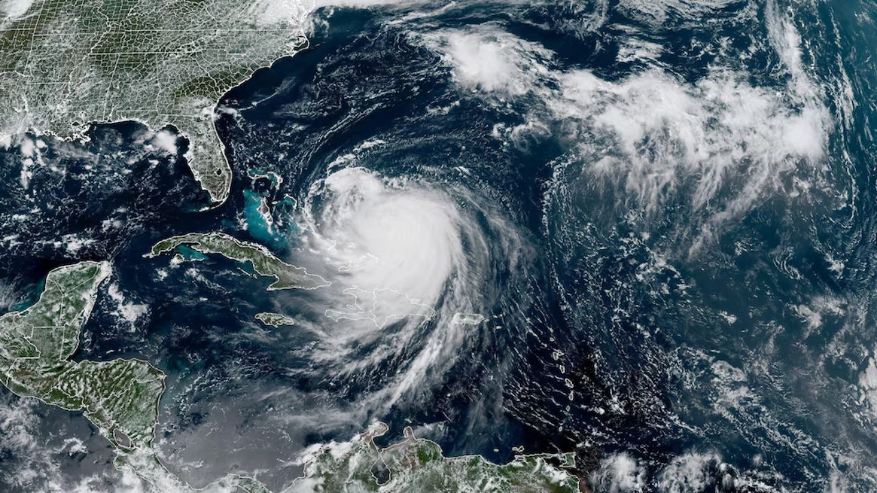
As of Thursday, Erin was a Category 2 hurricane, with maximum sustained winds of 105 mph. The storm was located about 200 miles southeast of Cape Hatteras, North Carolina, and moving north-northeast at 17 mph, according to the National Hurricane Center (NHC).
“Gradual weakening is expected over the next several days, and Erin is likely to become post-tropical by Saturday,” the NHC said in its forecast.
The storm had previously strengthened to a Category 5 before being downgraded as its intensity fluctuated over the past few days. A Category 2 hurricane has winds ranging from 96 mph to 110 mph, and although it’s below a Category 3 (major hurricane), Erin still has the potential to cause significant damage with winds near the upper threshold.
“Erin is a large storm, with hurricane-force winds extending outward up to 105 miles from the center,” NHC officials confirmed.
Tropical Storm Conditions and Evacuation Orders
Although Erin is not expected to make landfall in the U.S., tropical storm warnings have been issued for areas ranging from Beaufort Inlet, NC to Chincoteague, VA, with mandatory evacuations for Hatteras Island and Ocracoke Island in the Outer Banks. Authorities warned that storm surges could flood areas with 2 to 4 feet of water, and rip currents are likely to persist throughout the week.
“When there is flooding, there is great risk of death, and what we don’t want is for people to die,” said North Carolina Governor Josh Stein during a briefing on Wednesday, as he declared a state of emergency.
Forecast Path and Warnings for the U.S. East Coast
Erin is expected to remain offshore, passing between the U.S. East Coast and Bermuda through Thursday and Friday before curving northward. By the weekend, the storm is likely to pass south of Atlantic Canada. However, dangerous surf and rip currents will continue along the East Coast, including Jersey Shore and New York’s south-facing beaches.
“You’re allowed on the beach, but you will not be allowed in the water because we have treacherous conditions going on right now,” said Ed Schneider, beach patrol captain in Wildwood, NJ, speaking to CBS News Philadelphia.
Rip Currents Pose Deadly Risk
Rip currents, which are fast-moving narrow channels of water, are responsible for over 80% of beach rescues along the U.S. coast. These powerful currents can drag even experienced swimmers into deeper waters, posing a serious threat to beachgoers.
As a result, beach closures have been enacted in various areas, including popular destinations like Rehoboth Beach, Delaware, and parts of New Jersey. Forecasters warned that conditions could remain dangerous for days.
“It’s just not going to be a very safe environment to be in the ocean,” said Mike Brennan, director of the National Hurricane Center.
The Storm’s Formation and Atlantic Hurricane Season
Hurricane Erin formed as a tropical storm last week, off the coast of Cabo Verde in the Atlantic, and was the first hurricane of the 2025 Atlantic season. Erin is the fifth named storm of the season, following Tropical Storm Chantal and Tropical Depression Barry, both of which made landfall earlier this year.
Erin’s development underscores the peak of hurricane season, which typically runs from August to October. The National Oceanic and Atmospheric Administration (NOAA) has forecast an above-normal hurricane season in 2025, with between 13 to 18 named storms expected.
NOAA’s Hurricane Season Outlook
- 5 to 9 storms could become hurricanes (winds of at least 74 mph).
- 2 to 5 major hurricanes (Category 3 or higher).
- Tropical storm conditions expected to spread through the East Coast for several more days.
“We expect between 13 and 18 named storms this year, with 2 to 5 of them becoming major hurricanes,” NOAA officials warned, reflecting the typical spike in storm activity in August to October.
What are your thoughts on Hurricane Erin’s impact on the East Coast? Let us know in the comments.


