Houston, TX – The streak of daily rain across Southeast Texas isn’t over yet, as more thunderstorms are expected to roll through the region this weekend. A lingering frontal boundary remains the key player in the ongoing storm activity, with elevated flood risks and high humidity continuing into Saturday.
A Cooler, Damp Evening Across Houston
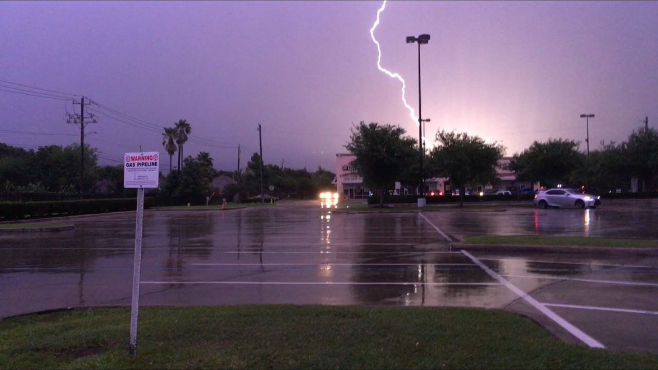
As Friday evening sets in, storm chances will gradually decrease, but residual moisture will keep roads slick in several neighborhoods. Rain-cooled air and thick cloud cover will help temperatures stay comfortable overnight. Commuters and evening eventgoers can expect mild conditions, though isolated areas may still deal with damp roads.
Elevated Flood Risk for Southeast Texas
The National Weather Service and local meteorologists warn of a continued flooding threat across much of the region due to persistent slow-moving storms. While no significant flash flooding has been reported from recent rounds, saturated ground and a stalled boundary mean just one more storm could tip the balance.
“This boundary along the I-10 corridor is acting like a fuse for these storms,” according to the KPRC 2 Weather Team, noting the system is responsible for multiple rounds of heavy rainfall this week.
Weekend Outlook: More Storms Ahead
Saturday brings a 60% chance of thunderstorms, primarily in the afternoon and evening. Highs will reach into the mid-90s, but humidity and rain will make it feel warmer. Expect strong downpours, especially in southern counties and near the coastline, where the boundary is forecast to stall once again.
Sunday offers a slight break from the soggy conditions, with only a 20% chance of an afternoon sea breeze storm. Highs remain in the 90s, but the overall feel will be slightly more tolerable as rain chances dip.
Monitoring the Tropics: Erin and What’s Next
While Hurricane Erin is now speeding away from the U.S., its effects are still being felt along the East Coast with dangerous rip currents and choppy surf through Friday.
Meanwhile, the National Hurricane Center is keeping an eye on two other systems in the Atlantic:
- A red-coded tropical disturbance has a 70% chance of developing into Tropical Storm Fernand within 48 hours. It is expected to follow Erin’s track, though farther east.
- Another system, marked in yellow, has a 40% development chance and may head toward the Windward Islands early next week.
Looking Ahead: A Brief Calm Before More Rain
After a wet Saturday, Sunday and Monday are shaping up to be more relaxed, with isolated storm potential but mostly dry skies. Temperatures will dip slightly thanks to lingering cloud cover and light breezes. However, Tuesday could mark a return to more active weather, so residents are encouraged to stay weather-aware.
What’s the weather like in your part of Houston this weekend? Let us know in the comments below.


