OREGON – The National Weather Service has issued a flash flood watch for parts of Oregon starting Tuesday at 11 a.m. and continuing through Wednesday at 11 p.m., warning of potential excessive rainfall and dangerous flooding conditions—especially in burn scar zones.
Counties Under Alert
The flood watch applies to the Lower Treasure Valley, as well as Harney, Baker, and Malheur counties. Residents in these areas are advised to be on high alert, as flash flooding could develop rapidly, particularly near recent wildfire zones where the soil is less able to absorb water.
“Flash flooding caused by excessive rainfall is possible,” the National Weather Service stated. “Heavy rainfall could trigger flash flooding or debris flows in and near recent wildfire burn scars.”
In addition to rural areas, urban street flooding is also a concern with the stronger storms expected to roll through the region as per OregonLive.
Be Prepared: Understanding Flood Alerts
To help residents respond appropriately, here’s a quick breakdown of flood-related alerts:
- Flood Watch: Be prepared. Conditions are favorable for flooding, but it hasn’t happened yet.
- Flood Advisory: Be aware. Minor flooding may cause inconvenience but not immediate danger.
- Flood Warning: Take action. Flooding is happening or imminent.
- Flash Flood Warning: Take immediate action. Flash floods are either occurring or will occur soon, and quick response is critical.
How to Stay Safe During Flood Conditions
Authorities urge residents in flood-prone or low-lying areas to plan now and stay informed as conditions develop. Key flood safety measures include:
- Move to higher ground if you live or camp in a flood-prone zone.
- Follow evacuation orders from local officials promptly.
- Disconnect utilities and appliances to prevent electrical hazards if flooding is imminent.
- Avoid basements or submerged areas, especially where electrical outlets are underwater.
- Do not walk through floodwaters—just six inches of fast-moving water can knock you off your feet.
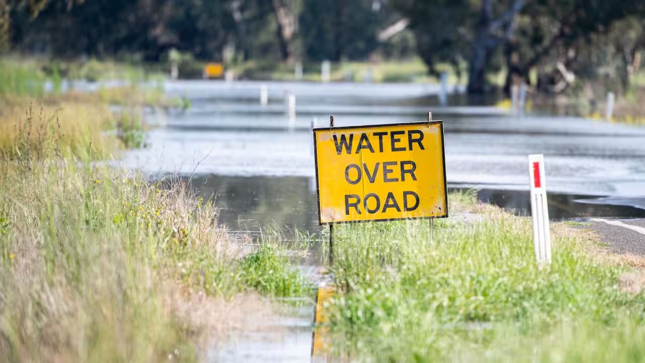
- Never drive through flooded roads. As little as 12 inches of fast-moving water can carry away most vehicles.
If you find yourself trapped by rising water, seek the highest ground possible and call 911 for emergency help.
What to Expect in the Coming Days
While exact rainfall totals remain uncertain, the potential for flash flooding and mudslides—particularly near areas recently impacted by wildfires—is serious. Emergency services are actively monitoring conditions and will issue warnings if the situation escalates.
Residents should stay updated by tuning into local news, NOAA radio, or emergency alerts, and prepare for the possibility of road closures, evacuations, or power outages.
Are you located in a flood watch area? How are you preparing for the incoming rain? Share your plans or tips in the comments below to help others stay safe.


