
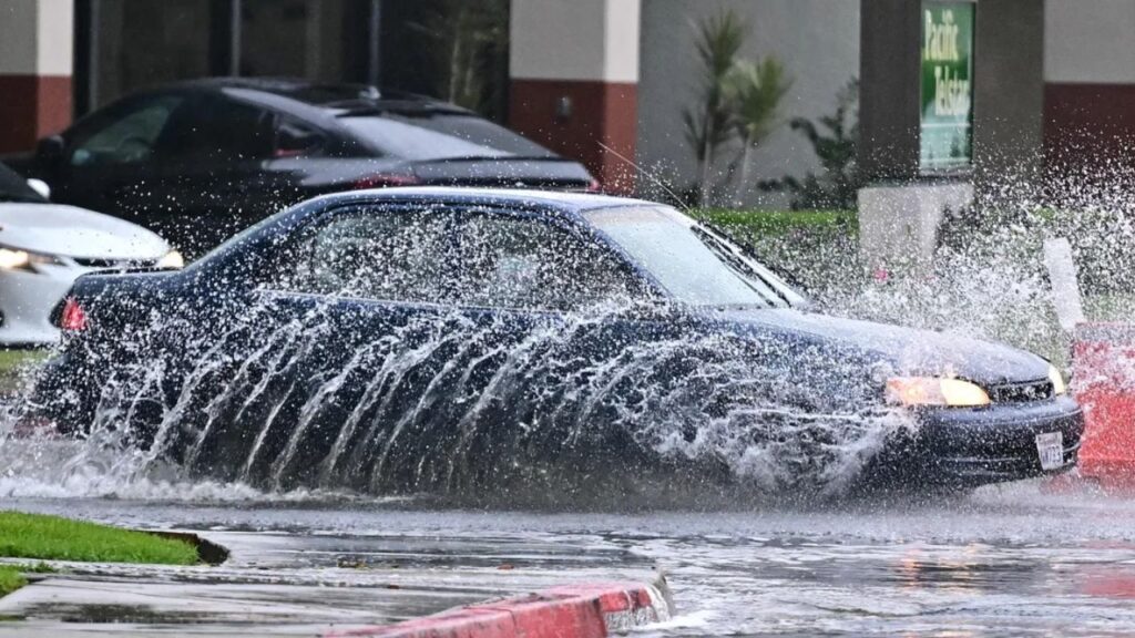
Los Angeles, Calif. – Emergency officials have issued evacuation warnings across parts of Southern California as a powerful Pacific storm barrels toward the region, expected to bring heavy rainfall, strong winds, and the threat of flooding and debris flows through the weekend.
According to the National Weather Service (NWS) in Oxnard, the storm is forecast to arrive Thursday night, marking the beginning of what could be a multi-day weather event impacting Los Angeles County and surrounding areas.
Forecasters Warn of Widespread Rain and Flood Risks
Meteorologists at KTLA are tracking a large low-pressure system approaching the coast, capable of producing bursts of intense rain between Thursday night and Saturday.
“Quite a bit of uncertainty in the progression of the storm exists, however, flooding of roadways and burn scars is possible, especially Friday and Saturday,” forecasters from the NWS Oxnard office said in their latest advisory.
The storm will likely bring two main rounds of heavy rain — the first between Thursday night and Friday morning, followed by another wave on Saturday.
How Much Rain to Expect
Rainfall totals are expected to vary widely across the region:
- Thursday afternoon: 0.1 to 0.2 inches of rain in Los Angeles County.
- Thursday night into Friday: Coasts and valleys may receive 0.75 to 1.5 inches, while mountain and foothill areas could see 1.25 to 1.75 inches.
- Friday: Another 0.5 to 1 inch of rain for coasts and valleys and up to 2 inches in higher elevations.
- Saturday: Between 0.5 and 1 inch of rain expected for coastal and valley regions, with up to 1.5 inches possible in the mountains.
During the heaviest downpours, rainfall rates may reach 0.25 to 0.5 inches per hour, with 0.5 to 0.75 inches per hour possible in mountainous areas — high enough to cause dangerous debris flows, particularly near recent burn scars.
Evacuation Warnings for Burn Areas
The Los Angeles Fire Department (LAFD) has issued evacuation warnings for neighborhoods near burn zones impacted by January’s firestorms, including areas around the Palisades, Eaton, Kenneth, Sunset, and Hurst burn scars.
These warnings take effect Thursday at 6 p.m. and remain in place through Sunday at 11 a.m., officials said. Residents in these areas are being urged to prepare for possible evacuations and avoid travel through canyons or flood-prone zones.
Gusty Winds and Travel Impacts Expected
The storm is also expected to bring strong, gusty winds. The Grapevine section of Interstate 5 and parts of the Antelope Valley could experience gusts up to 50 mph, while downtown Los Angeles may see winds near 20 mph.
Commuters are advised to allow extra travel time and exercise caution on wet and potentially flooded roadways — especially Friday and Saturday, when conditions are expected to be most hazardous.
In response to the weather threat, Caltrans announced the closure of a 3.6-mile stretch of Topanga Canyon Boulevard between Pacific Coast Highway (PCH) and Grand View Drive, starting Thursday at 10 p.m. The road will remain closed until weather conditions improve, officials confirmed.
Storm Timeline and Outlook
NWS Meteorologist Ryan Kittell described the incoming weather pattern as a “long-duration event,” noting that the region could see many hours of widespread rain through Saturday.
However, forecasters also warned that Saturday remains unpredictable, since the cut-off low has become detached from the jet stream, making its movements harder to track.
While some models suggest the storm could pull away from the coast, reducing rainfall, this remains the least likely scenario. By Sunday, the storm is expected to weaken, bringing only light showers — around 0.1 inch or less — before clearing out completely.
Are you preparing for the heavy rain and flood risks this weekend? Share your thoughts and safety tips in the comments below, and tell us how you’re planning to stay safe during the storm across Los Angeles County and the Southland.


