Washington, D.C. – A nor’easter is developing along the Carolina coast and is expected to move up the East Coast, bringing wet and windy weather to the Washington, D.C. region this weekend. Residents are advised to stay prepared as the storm impacts the area.
Nor’easter Timeline
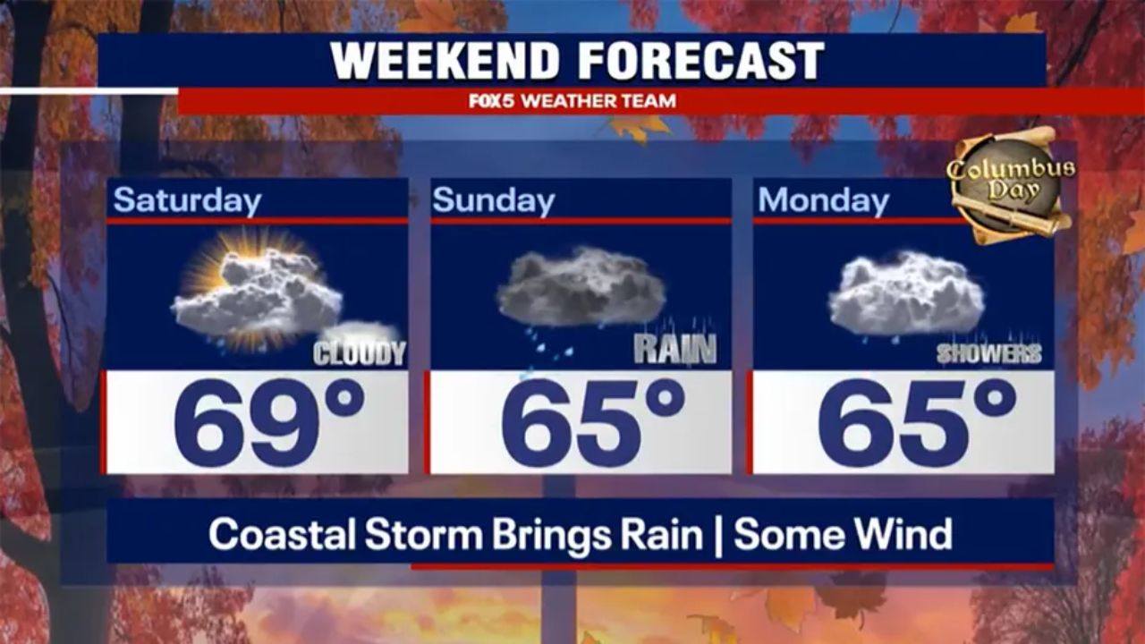
The heaviest rain is expected during the second half of the weekend, with the storm system clearing by early Tuesday. Calmer conditions are forecast for the remainder of the week.
Rainfall Expectations
Current forecasts indicate rainfall totals near 0.5 to 1.5 inches, depending on the storm track. Heavier amounts are more likely if the system moves slightly west or south. Coastal and eastern areas of the D.C. region may experience more intense rainfall.
Wind Forecast
Winds are expected to pick up as the weekend progresses:
- Saturday: 15-20 mph with gusts up to 22 mph in the evening
- Sunday: 20-25 mph with gusts up to 40 mph, especially in areas east of the bay
Residents near the coastal and eastern areas should expect windier and wetter conditions. As per Fox5DC; Monday will remain cloudy, while Tuesday may see a few stray showers before the system moves out to the Atlantic.
Potential Impacts on Weekend Events
- Saturday: Events like Snallygaster are expected to continue, as rain and wind remain light until later in the day.
- Sunday: The Army Ten Miler may face significant impacts with rain starting overnight and gusty winds in the 20-25 mph range, peaking up to 40 mph in the afternoon.
- Monday Night: The Commanders game should remain mostly dry, though cloudy skies and occasional showers are possible.
Overall, Sunday is expected to be the most problematic day, with rain and wind posing the greatest challenges.
Safety Advice
Residents are encouraged to stay safe and dry this weekend. Plan outdoor activities accordingly and monitor local weather updates as the nor’easter moves through the D.C. region.


