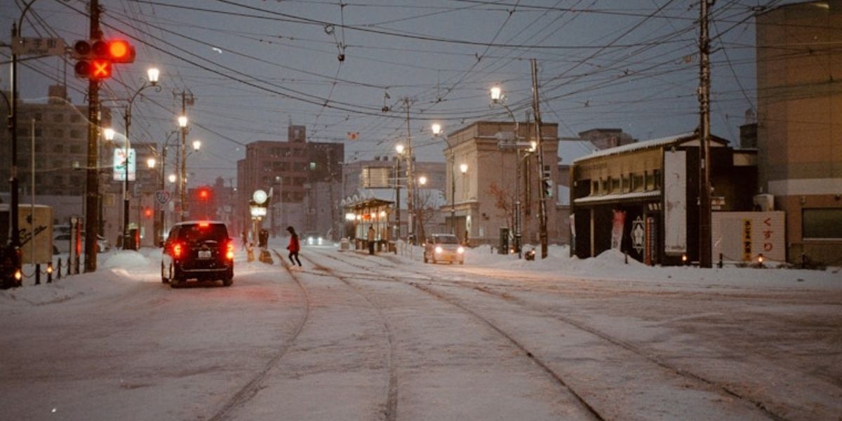
Indianapolis, IN – Central Indiana is wrapping up the weekend under a blanket of cloudy skies and persistently cold temperatures, according to local forecasters. While conditions remain dry through tonight and into Monday morning, temperatures are expected to dip into the low 20s, keeping residents firmly in winter’s grip even before the season officially arrives.
The chilly spell comes as the region sits beneath a stubborn cloud deck, limiting daytime warmth and keeping overnight lows especially frigid. Meteorologists caution that the cold pattern is far from over, with several rounds of active winter weather on the way.
Snow Returns Monday Night, Bringing Possible Tuesday Slick Spots
A renewed chance for snow is set to arrive late Monday, ushering in the first measurable flakes of the week. Though most of Monday will remain dry, conditions will stay cold and mostly cloudy, with afternoon temperatures peaking in the low to mid-30s—roughly 10 degrees below normal for early December in Indianapolis.
Light snow showers are expected to move into the area after dinnertime, continuing through the overnight hours. This system is forecast to drop a light coating of snowfall, enough to create slick spots for commuters heading out early Tuesday morning. Though accumulations will be minimal, forecasters stress caution for anyone traveling before sunrise.
Active Start to December as Cold Fronts Sweep the Region
The first two weeks of December are shaping up to be both cold and active, with multiple cold fronts and low-pressure systems expected to sweep across central Indiana. With each passing system, temperatures will continue to struggle to reach the 30s, falling short of the region’s typical early December high of 46 degrees.
This pattern marks a notably colder start to the month compared to recent years. Residents can expect more days where temperatures remain below freezing, reinforcing a pattern of early winter chill.
More Clouds Than Sunshine With Persistent Flurries
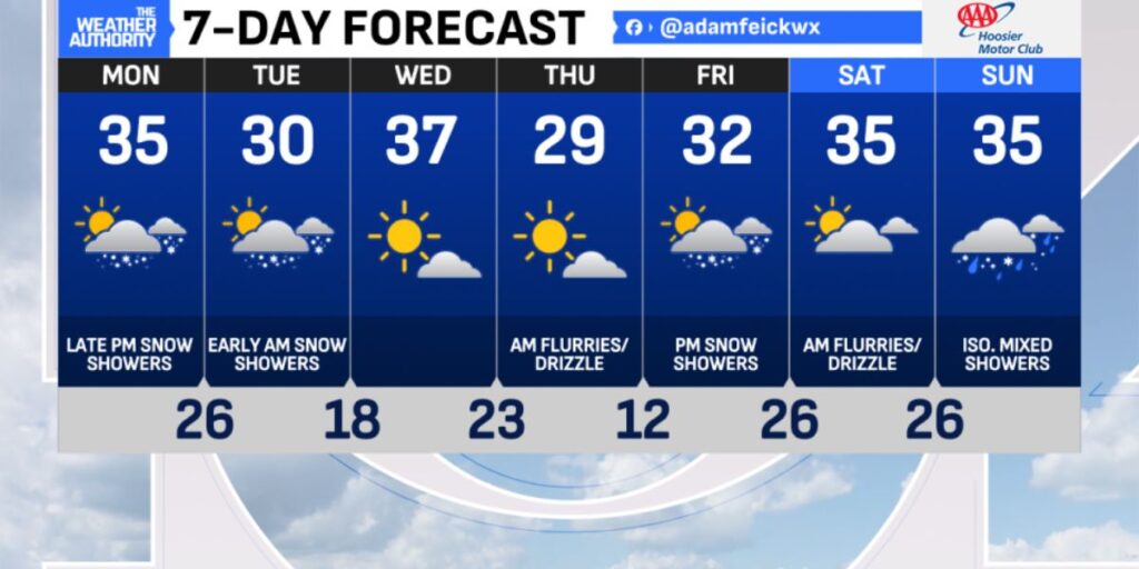
Looking ahead to the upcoming workweek, forecasters expect more clouds than sunshine, maintaining the gloomy feel that has settled over the region. A mix of stray snow showers, flurries, and even occasional drizzle is possible from midweek through next weekend.
Another low-pressure system is projected to sweep across the southeastern and then eastern United States late in the week. This may generate light snow showers across parts of Indiana between Friday and Saturday, though significant accumulation is not anticipated at this time.
High temperatures throughout the extended forecast will remain stuck in the 30s, while overnight lows will consistently fall into the 20s. A few of the coldest nights may even see readings dip into the teens, bringing some of the lowest temperatures of the season so far.
What to Expect and How to Prepare
Residents should prepare for a full week of classic early-winter conditions—grey skies, widespread cold, and periodic light snow activity. Light accumulations could impact roads at times, especially during the early morning hours. Layered clothing, careful driving, and winterizing outdoor items—including pets’ shelters—are all recommended as the cold pattern deepens.
How are you preparing for the cold week ahead in central Indiana? Drop your thoughts, winter tips, and local updates in the comments below—your insight helps the whole community stay ready!


