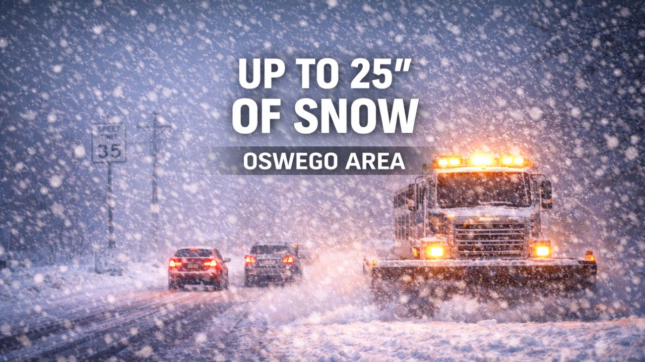
Binghamton, New York — A high-impact lake-effect snow event is ramping up across central New York, with conditions expected to rapidly deteriorate north of Interstate 90 as a powerful and persistent snow band takes aim at Oswego County. Forecasters warn that some areas near Lake Ontario could see up to 25 inches of snow between tonight and Saturday, making this one of the most dangerous snow events of the early winter season.
While the Southern Tier remains comparatively quieter, the situation near the eastern shore of Lake Ontario is expected to turn hazardous quickly.
Intense lake-effect band setting up tonight
According to the National Weather Service office in Binghamton, a strong lake-effect snow band is forecast to organize late tonight and persist into early Saturday, focusing its heaviest snowfall on areas east and southeast of Lake Ontario.
The most significant impacts are expected in Oswego and surrounding portions of Oswego County, where snowfall totals could approach or exceed 25 inches if the band remains stationary.
Key detail: Snowfall rates may reach 2 inches per hour or more, quickly overwhelming road crews.
Travel conditions expected to become extremely dangerous
Gusty winds accompanying the snow will create blowing and drifting, significantly reducing visibility during the heaviest bursts. Forecasters warn that near-zero visibility and whiteout conditions are possible at times.
Travel may become:
- Extremely dangerous
- Nearly impossible during peak snowfall
- Hazardous even on major roadways due to rapid accumulation
Roads could become snow-covered within minutes despite ongoing plowing operations, especially overnight.
Areas south of I-90 still face risks
While the most extreme snowfall is expected north of I-90, areas farther south are not entirely in the clear.
Communities including Syracuse, Cortland, and Ithaca may see lighter accumulations, but forecasters caution that even a small shift in wind direction could bring heavier snow into these areas.
Slick roads and reduced visibility remain possible across much of central New York, especially during overnight and early morning hours.
Cold temperatures increase accumulation efficiency
Temperatures across the region will remain well below freezing, with daytime highs in the teens to low 20s. These cold conditions will allow snow to accumulate efficiently, worsening travel impacts.
In addition, wind chills are expected to fall into the single digits, increasing the risk for anyone stranded outdoors or dealing with vehicle trouble during the storm.
Read Also: First Meteor Shower of 2026 Peaks This Weekend, but Moonlight May Limit the Show
Power disruptions possible in hardest-hit areas
Officials warn that the combination of heavy snow and gusty winds could lead to power outages, particularly in areas where snow piles up on trees and power lines.
Residents in Oswego County and nearby communities are urged to:
- Avoid unnecessary travel
- Prepare for prolonged hazardous conditions
- Ensure emergency supplies are stocked
- Check on vulnerable neighbors when safe to do so
Snow gradually weakens later Saturday
Lake-effect snow is expected to slowly weaken later Saturday, but impacts may linger well into the weekend due to deep snowpack, drifting, and continued cold temperatures.
Forecasters note that additional warnings or upgrades remain possible as the event unfolds, especially if snowfall rates intensify or the band stalls longer than expected.
Why this event is especially dangerous
Lake-effect snow events like this can be highly localized but extremely intense, meaning conditions can vary dramatically over short distances. One community may see light snow, while another just miles away experiences crippling conditions.
With confidence growing in significant snowfall near Oswego, officials stress that residents should take this threat seriously and avoid last-minute travel plans.
As winter tightens its grip on central New York, this storm serves as a reminder of how quickly conditions can change near the Great Lakes.
Are you seeing heavy snow or worsening conditions where you live? Share your local updates in the comments and help others stay informed as this dangerous lake-effect event unfolds.


