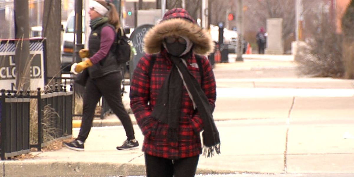
Indianapolis, IN – Central Indiana is experiencing a bitterly cold but calm end to the weekend, with temperatures expected to remain below zero overnight. A Cold Weather Advisory is in effect through 10 a.m. Monday, and residents are urged to dress in layers and cover exposed skin as wind chills will feel like -10 to -15 degrees through the morning hours.
Monday Brings Cold but Sunny Skies
The start of the workweek will remain cold but sunny. High temperatures are expected to reach the mid-20s under mainly clear skies, while sunshine helps brighten the day despite the frigid air. Residents are encouraged to take precautions when outdoors, particularly during the morning commute, when wind chills remain dangerously low.
Temperatures Rise Through the Workweek
The bitter cold won’t last long in Indianapolis. Temperatures are forecasted to rise above freezing by Tuesday afternoon, providing relief from the weekend’s frigid conditions. By Thursday, highs could even reach into the 50s, significantly above average for this time of year.
With the warming trend comes increased rain chances Thursday, which may bring brief periods of wet weather to central Indiana. Following this, Friday will see a temporary cooldown, with highs dropping back into the 20s.
Weekend Outlook: Mild and Above Average
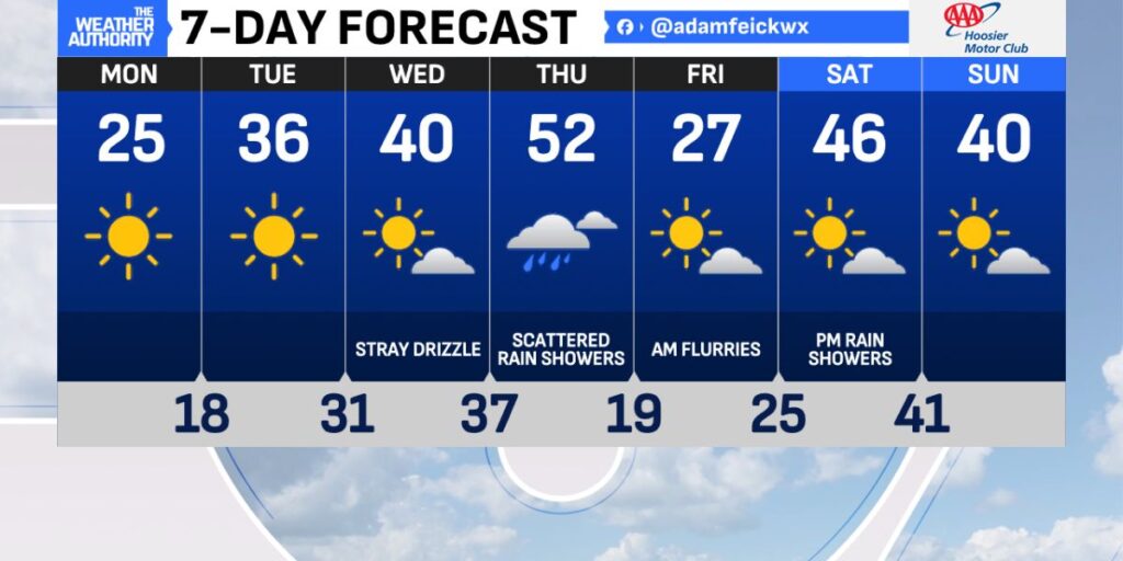
Looking ahead, Indianapolis is expected to warm again over the weekend, with highs in the 40s, slightly above normal for this time of year. Rain chances are possible late Saturday evening, offering a mix of mild temperatures and wet conditions.
Forecasters note that once temperatures rise above freezing this week, the trend is expected to continue with at or above normal temperatures leading into Christmas, potentially impacting holiday travel and outdoor activities.
Summary
Indianapolis is transitioning from a cold, below-zero start to the week to a warming trend that will bring highs above freezing by midweek. Residents should be prepared for wind chills below zero on Monday morning, followed by mild conditions, rain showers Thursday, and above-average temperatures into the weekend.
Staying informed about shifts in weather patterns will be essential for planning travel and outdoor activities as the holiday season approaches.
How Are You Preparing for Indianapolis’ Weather Changes?
Will you bundle up for the cold Monday morning, or are you looking forward to warmer midweek temperatures? Share your thoughts and plans in the comments below.


