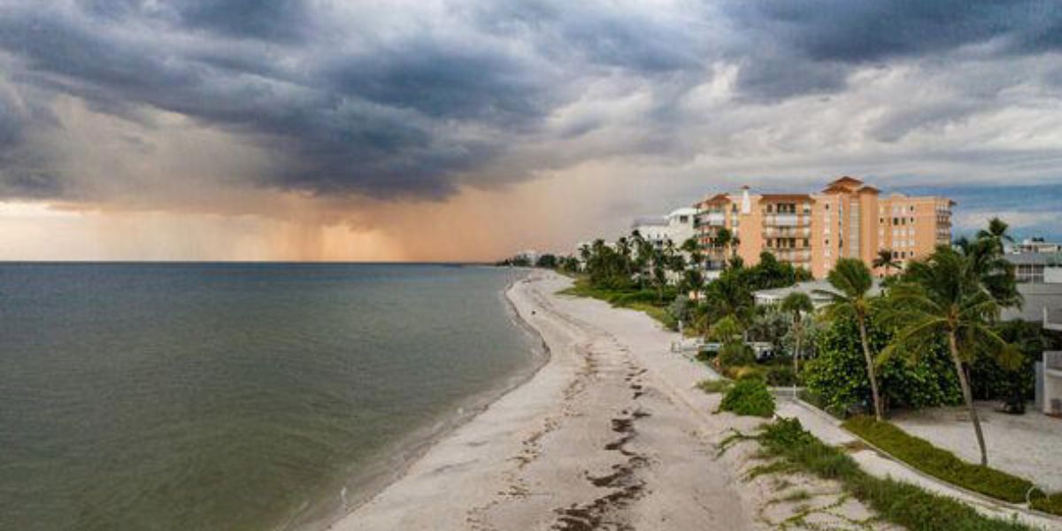
Orlando, Florida – Residents across Central Florida, especially in Orlando, are being urged to prepare for a dramatic winter weather shift as strong winds, dense fog, and plunging temperatures arrive just days after a warm and sunny Christmas. Forecasters warn that New Year’s Eve could bring some of the coldest conditions seen since late 2025, marking a sharp and sudden return to winter.
While the holiday week began with near-perfect weather, the atmosphere is now setting the stage for a rapid cooldown driven by an incoming cold front and strengthening high-pressure system.
Winds and Temperatures Set to Drop Rapidly
Meteorologists say temperatures will fall quickly between Monday and Wednesday, catching many residents off guard. Gusty winds associated with the advancing high-pressure system will amplify the chill, creating freezing or below-freezing “feels-like” temperatures for much of the region.
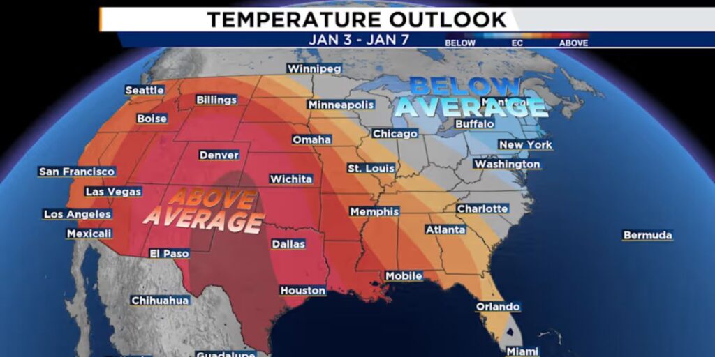
By Wednesday morning, parts of Northern and inland Central Florida could wake up to temperatures as low as 25 to 30 degrees, particularly with strong north winds still blowing. In Orlando, conditions are expected to hover near freezing, meaning residents are not out of the danger zone this time.
Forecasters describe the shift as one of the most dramatic temperature changes the area has experienced in months.
Dense Fog to Impact Monday Morning Commute
Before the cold air fully settles in, Monday morning is expected to begin with dense fog across Central Florida, significantly reducing visibility.
Some neighborhoods, including areas of northeastern Polk County and western Osceola County, recently experienced visibility as low as 100 yards. Similar conditions are expected again due to high moisture levels and low atmospheric mixing.
Drivers are urged to slow down, use headlights, and allow extra travel time. Visibility is expected to gradually improve, though forecasters say fog may not fully lift until after 10 a.m.
Cold Front to Sweep Through Quickly
Attention then turns to the fast-moving cold front, which is expected to enter the region between 7 p.m. and 9 p.m. Monday evening, exiting the area by midnight to 1 a.m.
While there is a slight chance of an isolated rain shower, meteorologists say most forecast models indicate the atmosphere is too dry to produce meaningful rainfall.
This lack of rain raises concerns, as drought conditions are already intensifying across Florida, a trend that was predicted months ago with the development of La Niña conditions in the Pacific.
Winds Flip, Cold Air Takes Over
As the cold front clears the area, winds will shift sharply to the north, increasing in speed almost immediately. This sudden wind change will accelerate the arrival of colder air, causing temperatures to drop below seasonal averages in a matter of hours.
Forecasters compare the shift to flipping on a ceiling fan—fast, abrupt, and impossible to ignore.
The coldest period is expected to arrive Wednesday and Wednesday night, lining up directly with New Year’s Eve celebrations.
New Year’s Eve: Cold but Calmer
There is some good news for those planning to ring in the new year outdoors. While temperatures will remain cold, winds are expected to ease Wednesday evening as the high-pressure system settles over the Gulf of Mexico.
This means that while jackets, coats, and layers will be essential, the wind chill may not be as harsh during evening festivities as it will be earlier in the day.
Layer Up and Protect Your Health
Weather experts strongly encourage residents to dress in layers, especially during Tuesday night, Wednesday morning, and New Year’s Eve. Layering helps retain body heat and offers flexibility as conditions change throughout the day and evening.
Health considerations are also important. Rapid weather swings like this can put stress on the immune system, increasing the risk of seasonal illness. Staying hydrated, resting well, and limiting prolonged exposure to the cold are all recommended.
Gradual Warming Trend Ahead
Looking beyond the holiday, conditions are expected to slowly improve. Starting Thursday, temperatures will begin a gradual warming trend as the high-pressure system modifies over warmer Gulf waters.
While it won’t immediately return to Christmas-like warmth, the worst of the cold is expected to be short-lived.
How are you preparing for the coldest New Year’s Eve Central Florida has seen in months? Are you bundling up or staying indoors? Share your New Year’s plans, weather tips, or reactions in the comments below and join the conversation.


