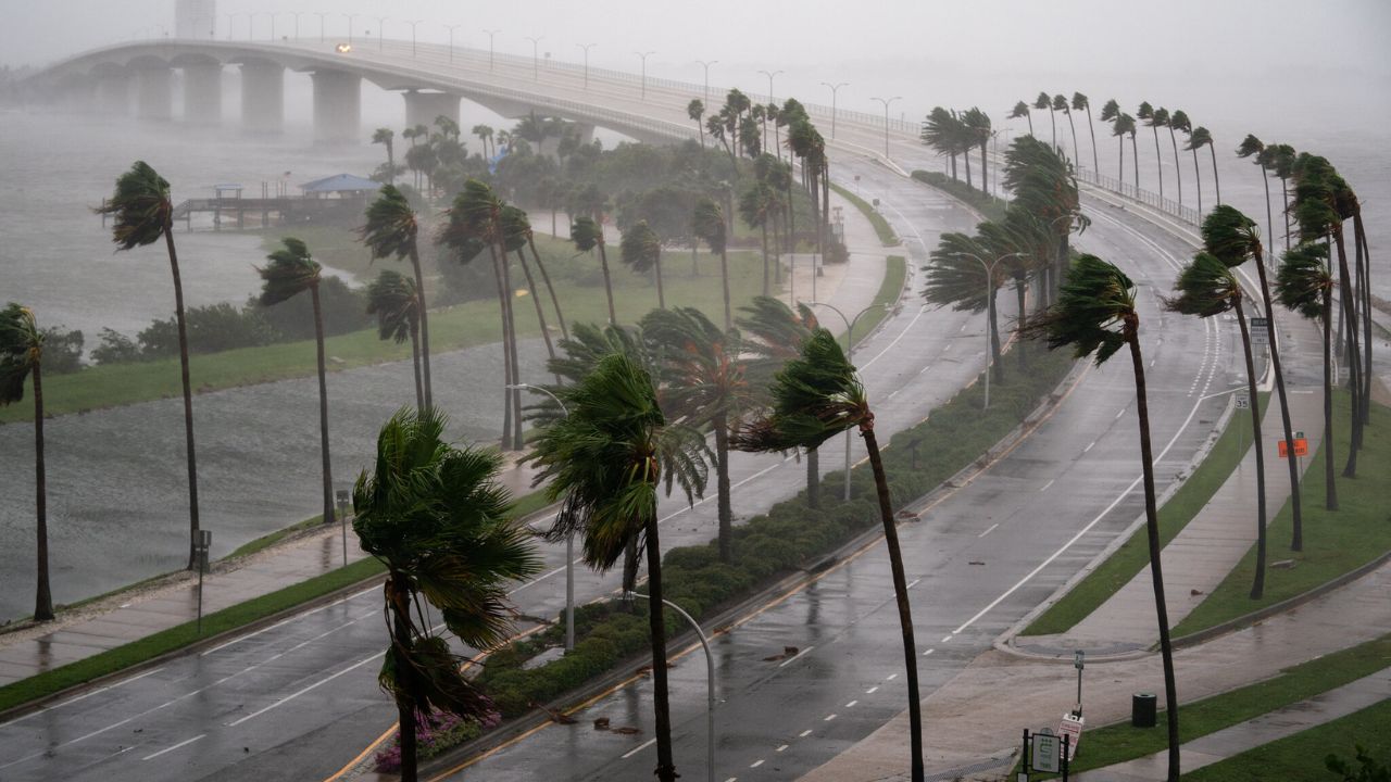
Orlando, FL — Central Florida continues to deal with strong storms, persistent rainfall, and a significant flooding threat as we move into Monday. Although Major Hurricane Melissa is spinning hundreds of miles away in the Central Caribbean Sea, its powerful wind circulation is directly influencing the weather over Florida.
The moist tropical air being drawn into the state is combining with the leading edge of a new storm system expected to sweep across the southeastern United States by Monday afternoon. This interaction is turning the atmosphere into a rain-producing engine, keeping storm chances high and conditions dangerous.
Stalled Front Intensifies Rainfall
Meteorologists report that a stationary frontal boundary — once lingering over South Florida near the Florida Keys — is now stretched across Central Florida. Acting like a “ramp” for storms, it is helping funnel moisture directly over the region.
Because this boundary isn’t moving, areas experiencing heavy rainfall will continue to see relentless downpours, heightening the flash flood risk.
Flash Flood Warnings and Hazardous Conditions
Multiple flash flood warnings have already been issued across the Florida peninsula.
Severe Impacts in Brevard and Lake Counties
- Brevard County has endured intense onshore storms, featuring:
- Wind gusts of 40–45 mph
- Rainfall rates of 3–5 inches per hour
- Lake County is also facing flash flooding, with warnings extending well past sunset
Drivers across both counties are urged to avoid flooded roadways, as hazardous travel conditions are expected to worsen into Sunday night.
Even though Central Florida recently experienced a stretch of dry weather, the ground is still saturated from rain events back in September and early October — making it easier for floodwaters to rise quickly.
Monday Commute at Risk

Meteorologists warn that Monday afternoon will bring the strongest storms and highest chances for widespread rainfall. This timing could disrupt school pickups, evening commutes, and local business operations.
There’s also a possibility that some residents could wake up to rain early Monday morning, depending on how much tropical moisture remains overnight.
Forecasters expect gusty winds, low visibility, and ponding on roads all day long. Monday is shaping up to be wet, windy, and gloomy across Central Florida.
Cold Front and Halloween Outlook
The same cold front that is triggering Monday’s rainy mess will eventually push through the state, bringing dramatic improvements in weather conditions later in the week.
Just in time for Halloween, residents can look forward to:
- Drier skies
- Comfortable temperatures
- The first true cold snap of the season
After days of humidity and thunderstorms, this cooldown will feel like a welcome shift for families planning costumes, gatherings, and outdoor festivities.
Community Advisory
Residents are encouraged to:
- Monitor local weather alerts
- Avoid driving through flooded roads
- Secure outdoor items due to strong winds
- Keep rain gear ready for Monday and Tuesday
Emergency crews remain ready to respond if flooding worsens.
What Do You Think?
Are you experiencing flooding or storm impacts in your neighborhood? Share your updates or concerns in the comments below. Stay safe, Central Florida!


