
Los Angeles, CA — A dry storm system pushing into Southwest California is forecast to unleash several days of strong winds and sharp temperature drops across Los Angeles and Ventura counties, according to the National Weather Service (NWS).
The incoming system is expected to create widespread gusty conditions and nighttime temperatures that dip near or below freezing in several inland communities through Friday morning.
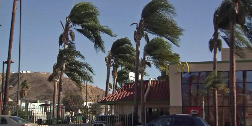
Widespread Wind Gusts Across Valleys and Mountains
Forecasters say winds will begin strengthening early Monday, with gusts reaching approximately 45 miles per hour across coastal and valley regions, while areas along the Malibu coast may see gusts around 35 miles per hour. Stronger blasts—up to 50 miles per hour—are predicted for the San Gabriel Mountains and the Santa Susana Mountains, posing risks for outdoor activities and travel.
After a short break in activity, forecasters warn of a second round of intensified winds during the midweek period. On Wednesday and Thursday, mountain regions may experience gusts up to 55 miles per hour, while coastal and valley communities could see winds between 35 and 45 miles per hour.
The NWS cautions that these conditions may create hazardous driving, especially for high-profile vehicles, and may also damage temporary structures, scatter unsecured outdoor items, and break tree limbs.
Plunging Nighttime Temperatures Expected
Once winds die down each night, temperatures are expected to plummet sharply. The coldest mornings—Tuesday, Thursday, and Friday—could bring readings near or below freezing across interior regions. The Antelope Valley is forecast to bear the brunt of the cold, facing some of the lowest temperatures of the week.
The NWS warns that the freezing conditions could cause harm to sensitive crops and plants, and may pose a moderate risk of hypothermia for unsheltered residents, vulnerable individuals, and animals. Local authorities emphasize the importance of checking on neighbors, securing pets indoors, and taking extra precautions to stay warm and safe.
Impact on Daily Life and Safety Measures
As the weather system settles in, officials recommend that residents secure outdoor furniture, holiday decorations, and lightweight structures, as they may be blown away or damaged by the forceful winds. Drivers—especially those operating trucks, RVs, or other large vehicles—are urged to remain vigilant on mountain passes and exposed roadways where sudden gusts could create dangerous travel conditions.
Homeowners are also encouraged to prepare for the cold snap by insulating vulnerable pipes, covering exposed vegetation, and ensuring adequate indoor heating. Livestock and outdoor pets should be provided with warm shelter to prevent cold-related stress.
Looking Ahead
While the system is expected to remain mostly dry, the combination of high winds and frigid temperatures will make for an unusually harsh week across Southwest California. Meteorologists will continue monitoring the shifting pattern and may issue additional advisories as conditions evolve.
Residents are encouraged to stay alert for updates from the National Weather Service and local emergency officials throughout the week.
How prepared do you feel for the incoming freezing temperatures and powerful winds? Share your thoughts, experiences, and updates in the comments below—your insight could help others stay safe!


