Indianapolis, Indiana – Central Indiana is bracing for its first significant blast of winter as a powerful weather system is set to arrive Saturday, bringing heavy snow, strong winds, and hazardous travel conditions. Forecasters warn residents to prepare now, as the storm is expected to impact large portions of the region through Sunday.
According to the National Weather Service, a Winter Storm Warning will be in effect from 7 a.m. Saturday through 10 a.m. Sunday for counties along and north of the I-70 corridor. Areas south of I-70 will be under a Winter Weather Advisory during the same timeframe.
Cold Overnight Conditions Ahead of the Storm
Dry weather will hold overnight, but skies will become increasingly cloudy as temperatures drop into the lower 20s. By early Saturday, the leading edge of the storm will begin pushing into the state.
Meteorologists advise that road conditions Saturday morning may deteriorate quickly as snow begins accumulating.
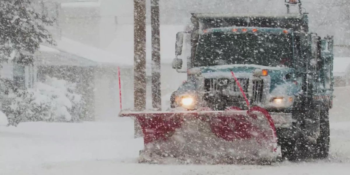
Heavy Snow and Strong Winds Expected Saturday Afternoon
Snow is forecast to move in Saturday morning and become steady to heavy by the afternoon. Forecasters warn that wind gusts up to 25 mph may blow snow across roadways, significantly reducing visibility and making travel more dangerous.
Snowfall intensity will increase throughout the day, especially in areas north of Indianapolis. Locations closer to the Lafayette-to-Marion line are expected to see the highest totals from this system.
Rain/Snow Mix Likely South of I-70
As warmer air pushes into southern Indiana Saturday night, a rain-and-snow mix may develop. This shift is expected to limit snowfall totals in areas south of Indianapolis.
While central and northern counties will stay mostly snow, regions south of I-70 could see rain blending in, reducing accumulation but increasing slushy and slick road conditions.
Snow and Wintry Mix Continue Into Sunday
The storm will linger into Sunday morning, with snow or a wintry mix tapering off by the afternoon. Though precipitation will end, skies will remain cloudy, and temperatures will hover near freezing.
Wind gusts may still reach 25 mph, which could create blowing snow and chilly conditions throughout the day.
Expected Snowfall Totals
Forecast snowfall includes:
- 1–2 inches south of I-70
- 2–4 inches in the I-70 corridor, including Indianapolis
- Heavier amounts farther north, especially from Lafayette to Marion
Drivers are urged to monitor conditions closely, plan extra travel time, and stay alert as roadways will likely be slick and visibility may be low.
Winter Pattern Continues Into December
Indiana is already coming off a colder-than-average November, and meteorologists say the chill isn’t going anywhere. The first week of December will continue the cold trend with highs in the lower 30s and yet another chance of snow on Tuesday.
Residents are encouraged to keep winter supplies on hand, prepare their vehicles for winter travel, and stay updated as forecasts evolve.
How Are You Preparing?
Central Indiana is about to enter its first major winter event of the season. Are you stocked up and ready for the storm? What’s your plan for navigating the weekend weather?
Share your thoughts and tips in the comments — your voice helps the community prepare!


