Houston, Texas – After weeks of dry weather, Houston and much of Southeast Texas are bracing for a stormy weekend, with heavy rainfall and potential flash flooding expected from Friday through Saturday.
Scattered Showers on Friday
Friday’s weather will mirror Thursday’s pattern, bringing scattered showers and thunderstorms throughout the day. Temperatures are forecast to reach the upper 80s, keeping things warm and humid ahead of a major shift in weather conditions.
Meteorologists at Click2Houston say the storms will remain isolated and short-lived on Friday, but conditions are expected to worsen by Saturday as a new front moves into the region.
Widespread Storms and Heavy Rain on Saturday
A strong cold front is set to sweep across Texas on Saturday, bringing widespread rain and thunderstorms to most of Southeast Texas, including Houston, Galveston, and surrounding counties.
Unlike Tuesday’s system, this front will be accompanied by a closer low-pressure center, which is expected to increase storm intensity. The proximity of this weather system means stronger winds, heavier rainfall, and localized flooding are more likely.
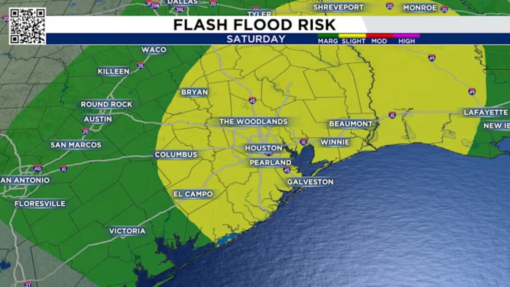
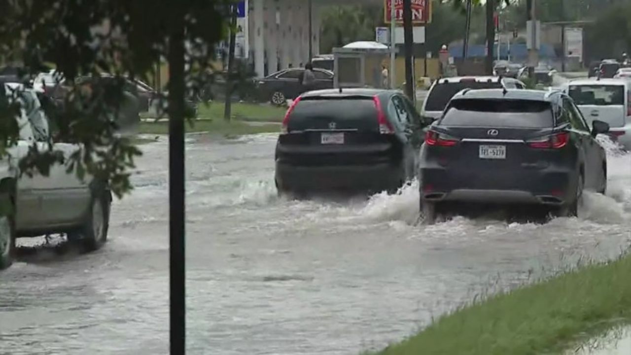
Because the region has been exceptionally dry for over a month, the sudden downpour could lead to street flooding, especially in low-lying and poorly drained areas. The National Weather Service has placed Houston under a Level 2 out of 4 flash flood threat for Saturday.
Officials are advising residents to stay alert for weather updates and avoid driving through flooded roadways.
Elevated Fire Risk Continues
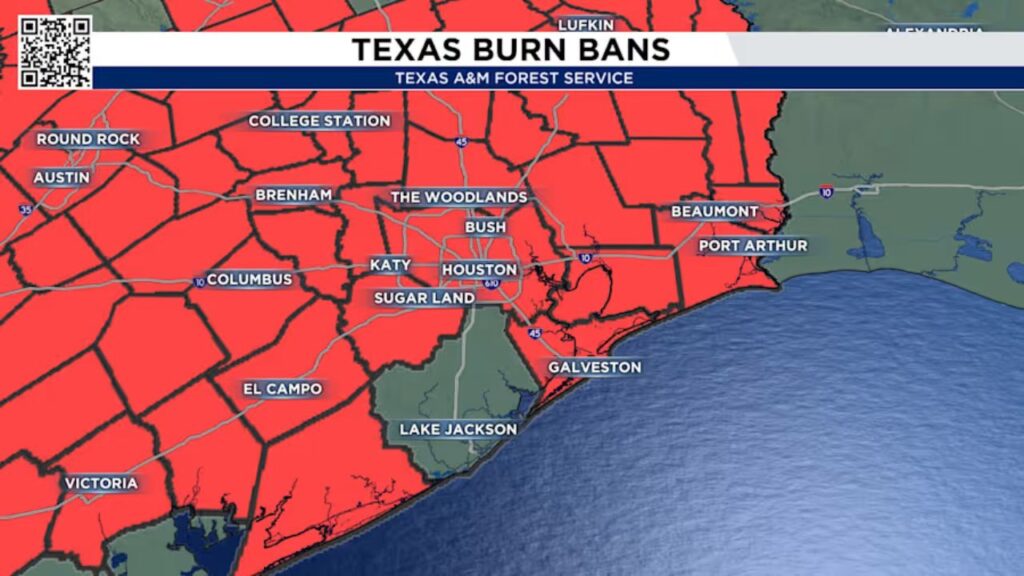
Despite incoming rain, burn bans remain in effect across much of the Houston area, with only a few counties currently exempt. The recent dry spell has left vegetation brittle, and any stray spark could lead to rapid fire spread.
Authorities continue to urge caution and remind residents to:
- Avoid spark-causing activities like welding or using power tools outdoors.
- Never leave fires unattended or burning without a purpose.
- Secure tow chains to prevent dragging and sparking.
- Avoid driving or parking over tall grass.
- Refrain from discarding lit cigarettes on the ground.
While the return of rain is a welcome change, experts note that several weeks of steady rainfall would be required to fully reduce fire danger and lift remaining burn bans.
Looking Ahead: A Strong Cold Front Next Week
Relief is on the horizon following the stormy weekend. A powerful cold front is expected to move through Houston by Tuesday, ushering in cooler temperatures and clear skies.
Highs will drop into the 70s, and overnight lows will sink into the 50s, marking the coolest temperatures of the season so far. Residents can expect sunny and pleasant weather—just in time for Halloween celebrations.
Stay Weather Aware
With the combination of stormy conditions, flash flood threats, and ongoing fire risks, Houston residents are urged to remain weather-aware throughout the weekend.
Keep an eye on local forecasts, avoid unnecessary travel during heavy rain, and follow all safety guidelines issued by local authorities.
What’s your plan for the stormy weekend in Houston?
Share your thoughts and experiences in the comments — are you preparing for rain, or ready to welcome the cooler weather ahead?


