ST. LOUIS, MO – A powerful cross-country storm system is expected to bring a potentially dangerous severe weather threat to millions of people across the Ozarks, Ark-La-Tex, and Mississippi Valley this weekend.
Meteorologists are warning residents to stay prepared as the system strengthens while moving across the central United States.
Storm Development Across the Country
According to the FOX Forecast Center, the storm began moving off the West Coast and into the Rockies earlier this week. While initial severe weather risks were relatively low, the threat is projected to increase significantly as the system progresses eastward over the weekend.
Scattered showers and thunderstorms may form from Oklahoma to Missouri, with some storms potentially reaching severe levels. The main hazards include damaging wind gusts and large hail.
Friday Night Into Saturday: Warm, Humid Air Fuels Storms
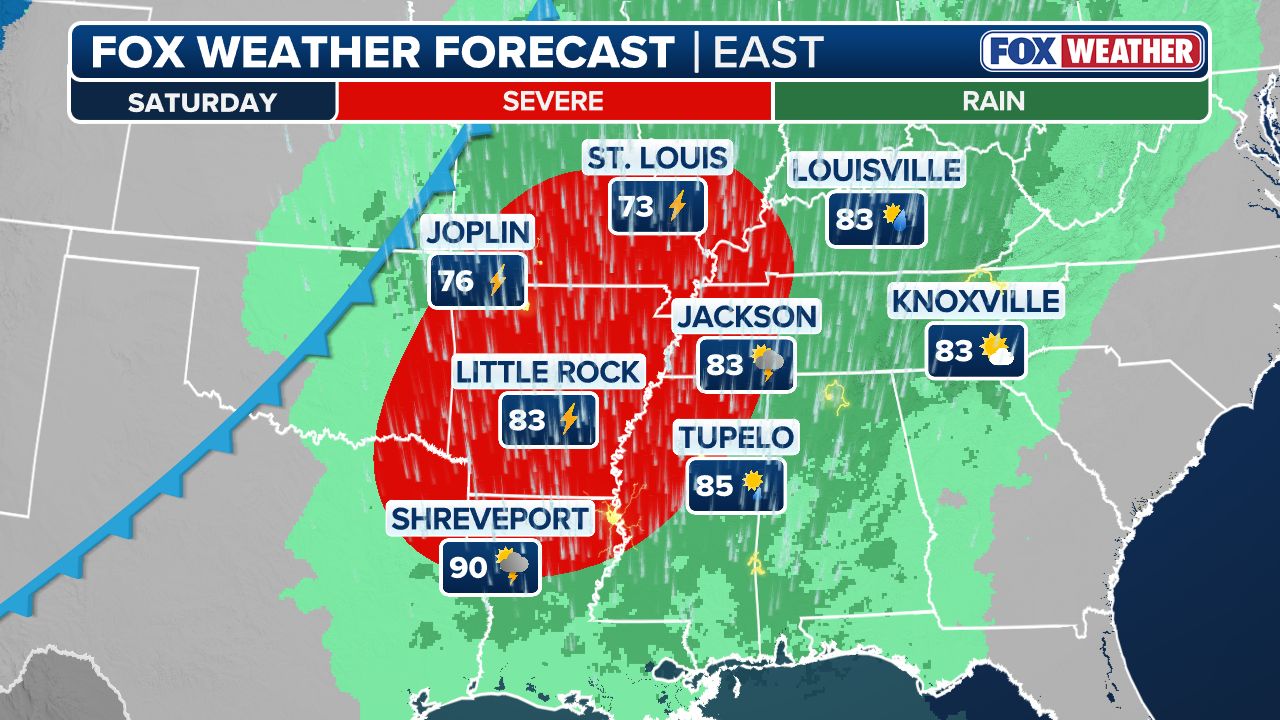
By Friday night and Saturday, warm, humid air is expected to surge northward into the Ark-La-Tex region, Missouri’s Ozarks, and the Mississippi Valley, creating a highly unstable atmosphere.
Forecasters warn that wind shear could support the development of supercell thunderstorms, capable of producing large hail, damaging wind, and tornadoes.
The severity of these storms will depend on how quickly the atmosphere can recover after early-day thunderstorms on Saturday. If the air heats up sufficiently in the afternoon, thunderstorms could become particularly intense, as per Fox Weather.
Saturday Evening: Threat Shifts Eastward
The severe weather threat is expected to move eastward into the lower and mid-Mississippi Valley by Saturday evening and night. Residents should remain alert for changing conditions and be prepared for possible flash flooding, high winds, and tornado warnings.
Areas at Highest Risk
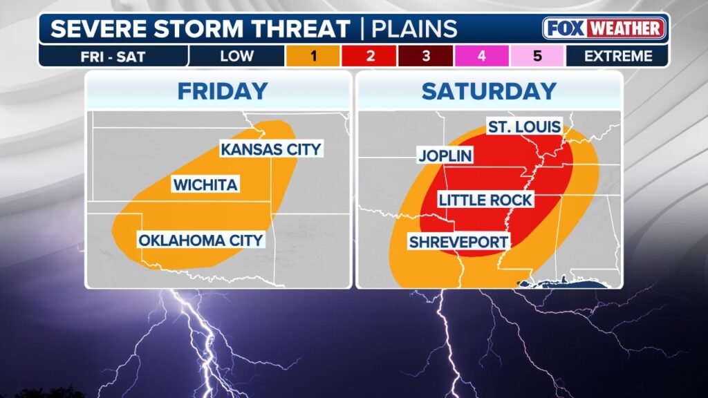
The NOAA Storm Prediction Center (SPC) has placed parts of the region under a Level 2 threat on its 5-point severe thunderstorm risk scale.
Cities currently in the threat zone include:
- Shreveport, Louisiana
- Fort Smith, Arkansas
- Little Rock, Arkansas
- Memphis, Tennessee
- Springfield, Missouri
Safety Recommendations
Meteorologists urge residents in the affected areas to:
- Monitor local weather updates and alerts
- Have a safe location ready for shelter during storms
- Avoid travel during severe weather conditions if possible
- Prepare emergency supplies, including flashlights, water, and non-perishable food
Share Your Preparedness Tips
Are you ready for the potential severe weather threat this weekend? How are you preparing for storms, hail, or tornadoes in your area?
Share your tips, experiences, and safety advice in the comments below — your guidance could help others stay safe.