Jersey City, NJ – New Jersey is bracing for a potentially significant coastal storm this weekend, with up to 60 mph winds, heavy rainfall, and tidal flooding, according to the latest forecasts.
Jersey Shore at Greatest Risk
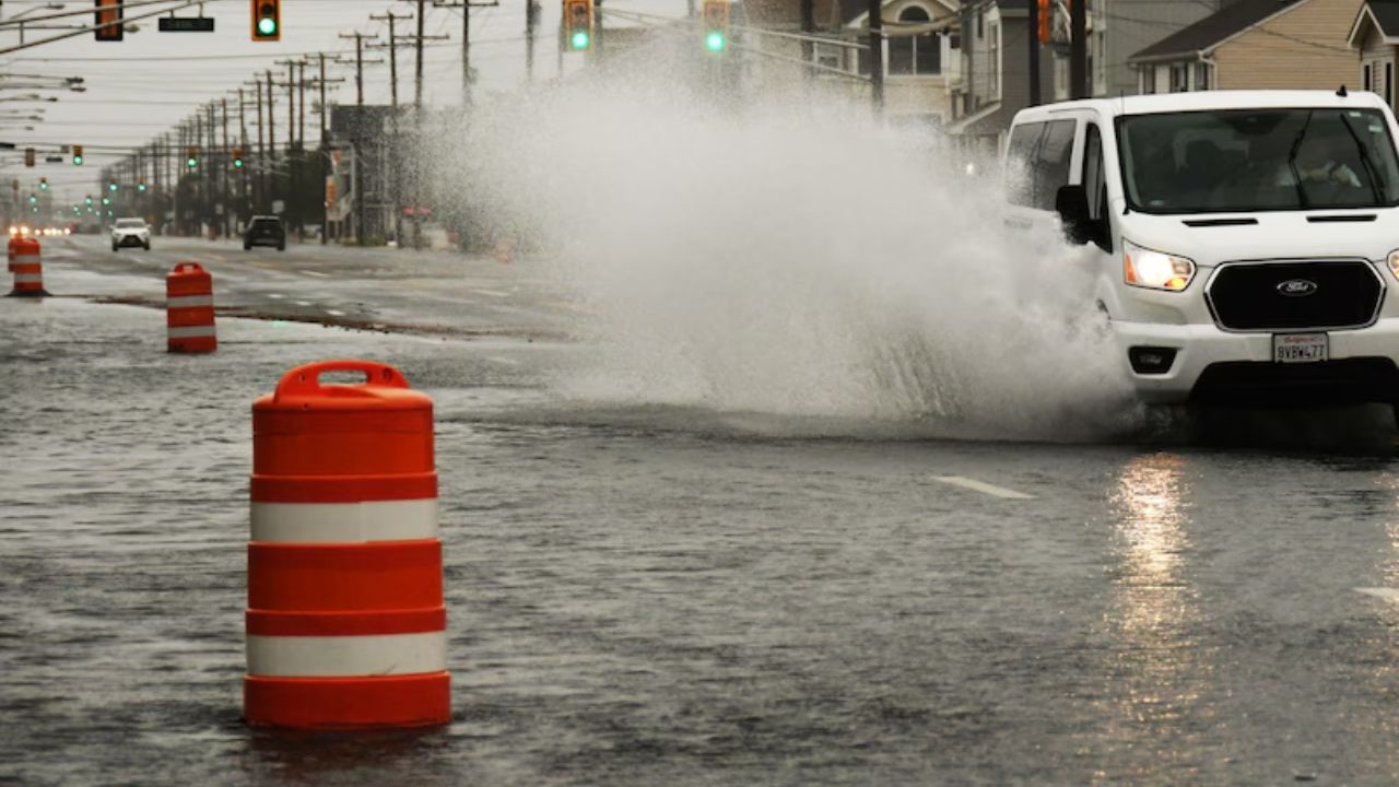
The Jersey Shore is expected to bear the brunt of the storm, with 2 to 4 inches of rain possible and beach erosion among the primary concerns, the National Weather Service reported. While the forecast is several days out, early data suggests the system “could be a significant to severe event.”
Storm Classified as Tropical Rainstorm
AccuWeather has described the system as a tropical rainstorm. Lead Hurricane Expert Alex DaSilva said,
“There is a high risk this storm will be designated a subtropical (hybrid) storm, which is why we have issued a tropical wind and rainstorm advisory and an eye path map to raise early awareness ahead of potential National Hurricane Center classification.”
Timing and Impact
The storm system is expected to develop late Saturday night, with rain spreading across the region. The strongest winds and heaviest precipitation are forecast for Sunday and Monday, particularly along the Jersey Shore.
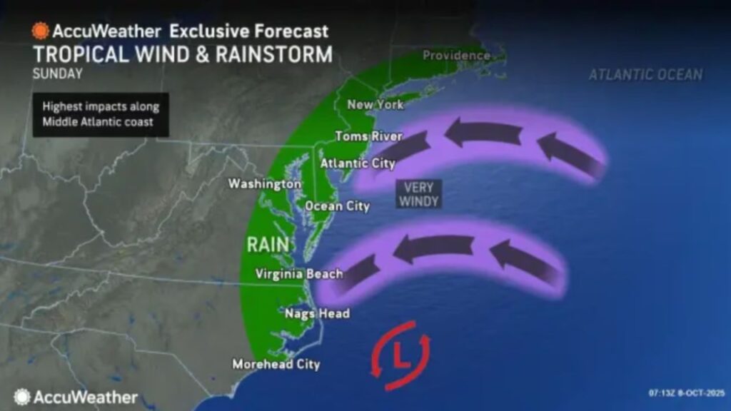
Northeast winds could gust 45 to 55+ mph along the coastline, with inland gusts of 30 to 40 mph reaching the I-95 corridor. Moderate to potentially major coastal flooding is expected along both the Jersey Shore and Delaware Bay, as per reports.
Residents in these areas are advised to prepare for impacts, including beach erosion and rising water levels.
Forecast Uncertainty
The exact storm track remains somewhat uncertain, which could influence the severity of local conditions. Weather patterns are expected to calm down by Tuesday and Wednesday, returning to typical mid-October conditions. Temperatures should remain near seasonal averages, with mostly dry conditions following the storm.
What do you think about this upcoming storm? Share your thoughts and preparations in the comments below!


