ARIZONA – After several days of hot and dry conditions, Arizona is preparing for a shift from high temperatures to rainy weather, with showers and thunderstorms expected later this week.
Tuesday and Wednesday: Heat with Clouds on the Rise
Phoenix saw highs reach 99 degrees on Tuesday afternoon, with lows falling to around 71 degrees by Wednesday morning. The night will remain clear and dry across the state.
Wednesday will start mostly sunny, with temperatures again climbing into the upper 90s. Clouds will increase during the evening and overnight, particularly near the White Mountains and east-central Arizona, where showers and thunderstorms are possible. Some light rain may also occur in far southern Arizona, though the Valley and most of the state will stay dry with low humidity.
Thursday and Beyond: Rain Moves In
From Wednesday night into Thursday, rain chances increase statewide. In Phoenix, the chance of rain rises to 30% on Thursday and Friday. By Thursday morning, humidity spikes, and scattered showers will move northward into the Valley and high country. Afternoon and evening will see isolated showers in the Valley, with temperatures cooling to the low 90s and 80s.
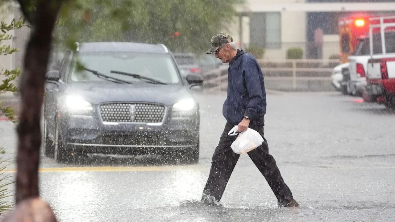
Weekend Outlook: Remnants of Hurricane Priscilla Bring Heavy Rain
The weekend marks the start of a five-day stretch of wet weather as remnants of Hurricane Priscilla move into the Southwest. The heaviest and most widespread rain is expected Friday through Sunday, with flash flooding risks particularly high in the Valley.
At times, heavy pockets of rain may develop, but Saturday has the best chance for widespread steady to heavier rain, followed by additional showers on Sunday, especially in southeastern Arizona.
Tropical Moisture and Potential Flash Flooding
The upcoming rainfall is driven by tropical moisture from Hurricane Priscilla. Early showers from Wednesday to Friday are due to moisture building ahead of Priscilla’s center, while rain chances intensify over the weekend as the remnant moisture moves across the state.
An additional tropical system may follow Priscilla’s path, potentially bringing more rain early next week (Monday-Tuesday). This long-duration rain increases the risk of flash flooding, with some areas potentially seeing over 2 inches of rainfall. The exact track and intensity of Priscilla will determine which areas receive the heaviest totals.
Stay Prepared
Residents are advised to monitor local forecasts, avoid flood-prone areas, and take precautions if traveling this weekend.
Join the Discussion
Are you preparing for the upcoming storms in Arizona? Share your plans and experiences in the comments below and let your neighbors know how you’re staying safe during this rainy stretch.


