Savannah, GA — A stalled frontal boundary draped across the Southeast is combining with developing low-pressure systems to create a prolonged period of heavy rainfall and flooding, stretching from the Interstate 10 corridor north through Georgia and the Carolinas.
2 Dead in Nash County, North Carolina Floodwaters
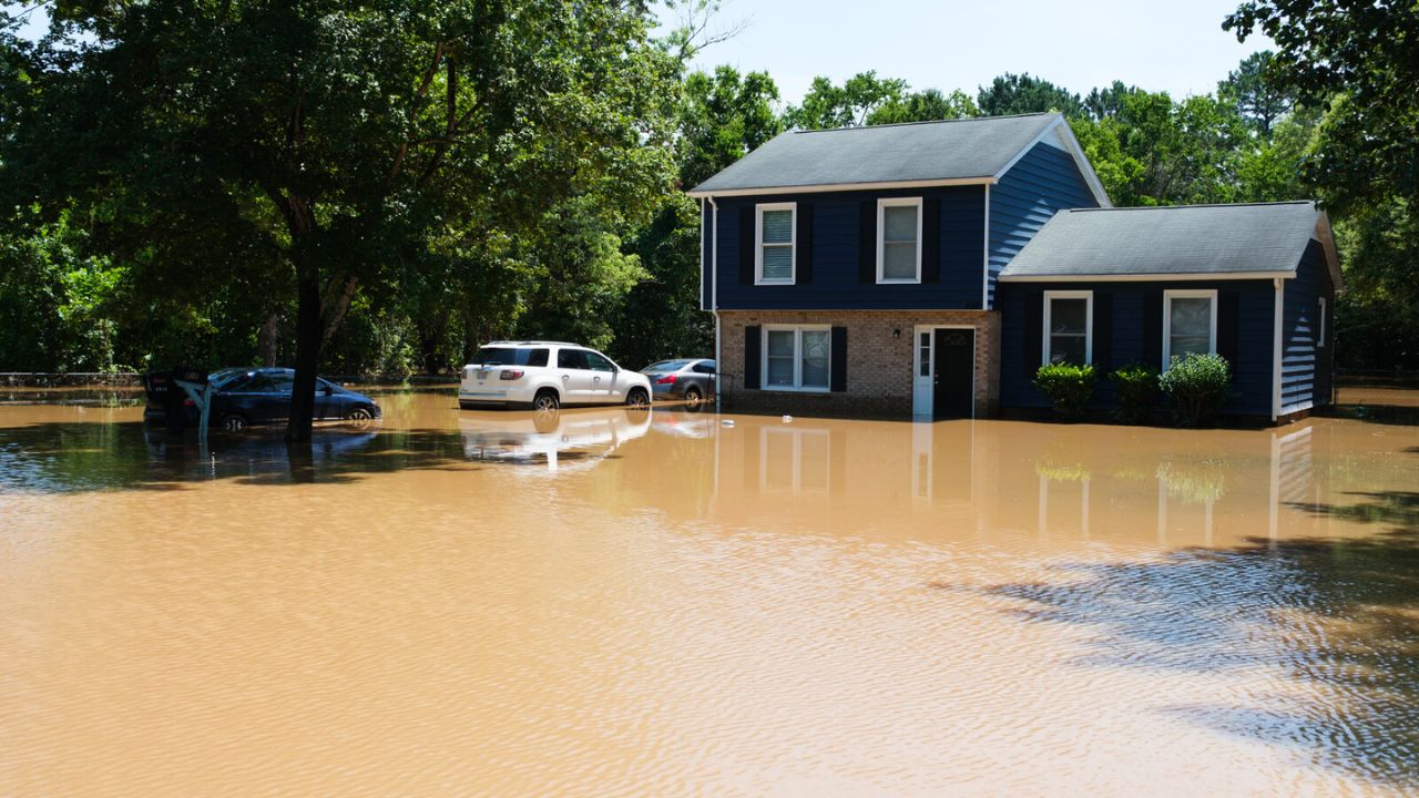
The flooding has already turned fatal. In Nash County, just outside Raleigh, North Carolina, a man and a woman died after their vehicle was swept into a ravine during flash flooding.
“The two got themselves out onto the roof, but the rushing water swept them both away,” authorities said. Their bodies were recovered after an extensive search and rescue operation.
Nash County Sheriff Keith Stone urged caution, especially when driving at night:
“During these storms, it takes up just a little bit of debris in these pipes and things of nature that are going under the roads to turn a low area into a flooded area. I caution you… it is acceptable to flood you,” Stone warned, according to FOX Weather.
Daily Rain Threat Through the Weekend
According to the FOX Forecast Center, the region could see daily rounds of rain and thunderstorms through the weekend, with some places potentially experiencing double-digit rainfall totals. Areas of concern include Charleston and Myrtle Beach, South Carolina, as well as Wilmington, North Carolina.
- Flood Watches are active in many counties and could quickly escalate to Flood Warnings if storms repeatedly hit the same areas.
- Ground is already saturated in parts of the region, making conditions ripe for flash flooding and drainage failure.
“The absence of a named storm does not lessen the threat,” meteorologists noted. “Significant daily rainfall remains a high probability.”
Tropical Activity in the Atlantic Monitored
All eyes are also on a disorganized tropical disturbance over the western Atlantic. Though the National Hurricane Center currently gives it a low chance of development, a Hurricane Hunter aircraft stands ready to investigate if needed.
“Rapid tropical development is not expected midweek, but forecasters remain vigilant for signs of organization,” FOX Weather reported.
Even without a formal tropical system, the persistent moisture, cloud cover, and instability are enough to sustain multiple rounds of heavy rainfall and potential severe storms.
Additional Weather Hazards Emerging
Forecasters also warn of:
- Isolated severe thunderstorms with damaging wind gusts and frequent lightning
- Rough surf and elevated rip current risks from Florida to the Carolinas, especially dangerous for beachgoers
Additionally, due to thick cloud cover and steady rain, many parts of the Southeast are reporting unusually cool daytime highs for this time of year. Several observation sites have recorded near-record-low high temperatures, particularly notable in the final weeks of meteorological summer.
Stay Alert, Avoid Flooded Roads
Officials are urging residents to:
- Avoid walking or driving through flooded roadways
- Monitor local alerts and warnings
- Stay indoors during lightning storms or heavy rain
Even in the absence of a hurricane, the persistent flood threat is proving to be both dangerous and deadly. Communities across the Southeast are advised to remain vigilant and prepared.
What’s your take on the flooding threat across the Southeast? Let us know in the comments.


