Chicago, Illinois – As an Atlantic Coast snowstorm exits the region, a persistent pattern of Canadian clipper systems is continuing to impact large parts of the Midwest and interior Northeast through midweek. These fast-moving winter storms are bringing cold air, lake-effect snow, gusty winds, and renewed travel challenges, according to AccuWeather.
Snowfall Continues After Weekend Clipper
A recent clipper storm spread accumulating snow as far southeast as eastern Pennsylvania, New Jersey, New York, and New England from Saturday into early Sunday. While snowfall amounts were generally light, the widespread nature of the system created slick road conditions across multiple states.
A secondary clipper began affecting the Upper Midwest on Sunday morning and is expected to continue pushing snow southeastward across the Great Lakes region through Sunday night.
Forecast Snow Totals Through Monday
Snow totals from this system are forecast to range from a dusting to around one inch across a broad corridor extending from western Minnesota to Ohio, West Virginia, western Maryland, Pennsylvania, and upstate New York.
However, higher totals of 1 to 3 inches are expected from central Minnesota through western Pennsylvania and western New York, particularly along the western slopes of the Allegheny Mountains.
Lake-Effect Snow to Intensify Accumulations
As cold air flows across the open waters of the Great Lakes, lake-effect snow will significantly boost totals during and after the storm. Northern and western Michigan are expected to see 6 to 12 inches of snow through Monday.
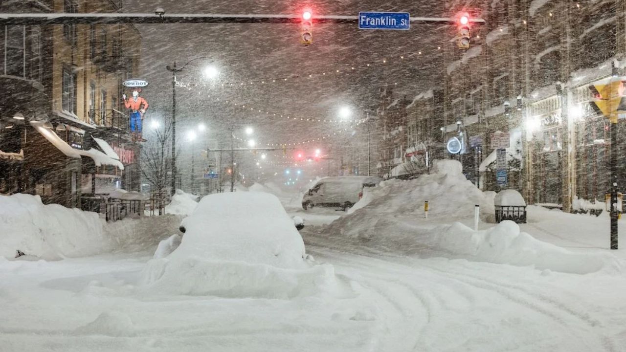
Heavy lake-effect bands will also impact northeastern Ohio, northwestern Pennsylvania, and western and northern New York, including areas near Buffalo. According to AccuWeather, the Local StormMax™ snowfall potential is as high as 20 inches in the most persistent lake-effect zones.
Gusty Winds and Reduced Visibility
Strong winds accompanying and following the clipper will cause blowing and drifting snow, leading to sharply reduced visibility at times. These conditions could make travel hazardous, especially in open and rural areas where drifting snow can quickly cover roadways.
Coldest Air of the Season Follows
Behind the storm, some of the coldest air of the season so far will settle across the Midwest on Monday. Temperatures are expected to fall near 0°F around Chicago, with single-digit lows in Pittsburgh.
AccuWeather reports that RealFeel® Temperatures could plunge much lower, with parts of the Midwest experiencing conditions that feel like -30°F to -40°F early Monday morning.
Another Clipper on the Way
The active pattern is not over. Another clipper system is forecast to track from Montana to Michigan between Tuesday and Wednesday, bringing additional snow and reinforcing the cold conditions.
Looking beyond midweek, forecasters say a potential pattern shift later in the week could allow more cross-country storm systems to develop, keeping winter weather concerns active across large portions of the U.S.