Denver, CO – Colorado is bracing for a high-impact weather event on Wednesday, as damaging winds, critical fire danger, and the potential for widespread power outages converge across the High Country, I-25 corridor, and parts of the plains, according to forecasters and state officials.
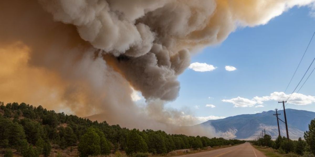
After another stretch of unseasonably warm and calm weather on Tuesday, conditions are expected to change rapidly. Meteorologists warn that the combination of powerful winds, very low humidity, and dry fuels could allow any fire to spread rapidly, especially in and around the Denver metro area.
High Winds Expected to Batter Mountains, Foothills, and I-25 Corridor
The National Weather Service (NWS) in Boulder has issued a High Wind Warning beginning at 11 a.m. Wednesday and lasting until midnight. Forecasters describe the system as a “high impact wind event” with the potential to cause significant disruptions.
According to the NWS, downslope winds will impact the mountains, foothills, and the I-25 corridor Wednesday afternoon through Wednesday night. Wind gusts of 60 to 85 mph are possible, with the strongest winds near the base of the foothills.
In higher elevations above 9,000 feet, wind gusts could approach 85 mph, while lower foothill communities and areas along the western side of I-25 may experience gusts between 50 and 70 mph. Breezy and gusty conditions are expected to extend into the eastern plains through Thursday morning.
“Damaging winds will blow down trees and power lines. Widespread power outages are expected. Travel will be difficult, especially for high-profile vehicles,” NWS forecasters warned.
Red Flag Warning Issued for Fire Danger
Alongside the wind threat, a Red Flag Warning will go into effect at 11 a.m. Wednesday for much of the I-25 corridor, including Fort Collins, Boulder, the Denver metro area, Castle Rock, and Colorado Springs.
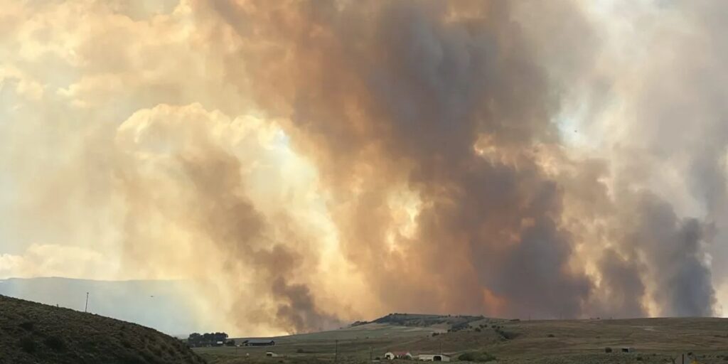
Meteorologists say the most critical window for dangerous fire behavior will be between 1 p.m. and 5 p.m. Wednesday, when winds peak and humidity levels drop even further.
“Unfortunately, with the warmer, dry, and windy conditions, we’re looking at higher fire danger,” said Lisa Hidalgo, Denver7 Chief Meteorologist. Any spark during this time could lead to rapid fire growth, officials cautioned.
Xcel Energy Plans Possible Public Safety Power Shutoffs
Due to the elevated wildfire risk, Xcel Energy announced it is preparing for a Public Safety Power Shutoff (PSPS) on Wednesday. If implemented, electricity would be proactively shut off in targeted areas to prevent power lines from sparking wildfires.
In a Tuesday afternoon news release, Xcel Energy said a likely PSPS could begin around 10 a.m. Wednesday, impacting approximately 52,000 customers across Boulder, Clear Creek, Jefferson, Larimer, and Weld counties.
The utility noted that recent infrastructure improvements and updated modeling allowed it to reduce the number of affected customers, and that the start time was moved earlier due to evolving weather conditions.
Xcel also warned that power outages could still occur outside PSPS zones, as extreme winds may cause trees or debris to strike power lines.
Before shutting off power entirely, the company may activate Enhanced Powerline Safety Settings (EPSS), which keep lines energized until a problem—such as a tree branch contacting a line—is detected. Once detected, power is automatically shut off to reduce fire risk.
Travel and Safety Concerns Across the State
The Colorado Department of Transportation (CDOT) is urging drivers, particularly those operating high-profile vehicles, to remain alert and be prepared to delay travel if conditions become unsafe.
Strong crosswinds could make driving hazardous on exposed highways, bridges, and mountain passes. Residents are also encouraged to secure loose outdoor items, avoid outdoor burning, and prepare for the possibility of extended power outages.
Snow Possible at Higher Elevations
While much of the state will remain dry, the same system bringing high winds may also deliver snow to Colorado’s higher elevations later Wednesday. In the Denver metro area, forecasters say there is a slight chance of showers late Wednesday afternoon into the evening, though impacts are expected to be minimal.
Stay Informed and Prepared
With dangerous winds, extreme fire conditions, and possible power shutoffs, officials urge Coloradans to stay informed, monitor local alerts, and take precautions to protect property and personal safety.
What do you think about Public Safety Power Shutoffs and their impact on communities during extreme weather? Are you preparing for the high winds and fire risk? Share your thoughts and experiences in the comments below.


