Anderson, IN – Central Indiana residents are experiencing a noticeable warmup after a chilly start to the week, with highs nearly 20 degrees warmer on Monday compared to Sunday. While temperatures remain below seasonal averages, meteorologists say this trend marks the beginning of a more comfortable midweek stretch.
Monday Evening: Chilly but Clear
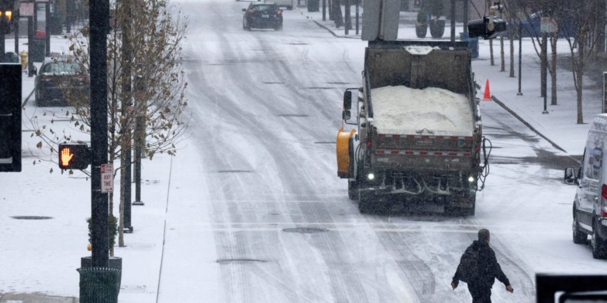
Monday evening will remain cold but dry, with mostly clear skies across the region. Residents should prepare for overnight lows dropping into the mid-teens, with wind chills in the single digits, according to local weather reports.
Sunny Skies and Gradual Warmup
The dry weather is expected to continue through Tuesday, bringing sunny skies and more comfortable conditions. Meteorologists are encouraging Central Indiana residents to enjoy the brief respite from wintry weather while it lasts.
By Wednesday, temperatures are forecast to rise into the 40s, continuing the warming trend. Early morning hours may bring a light wintry mix, but sunshine will dominate the rest of the day, offering a more springlike feel compared to the bitter cold earlier in the week.
Rain and Rising Temperatures Later This Week
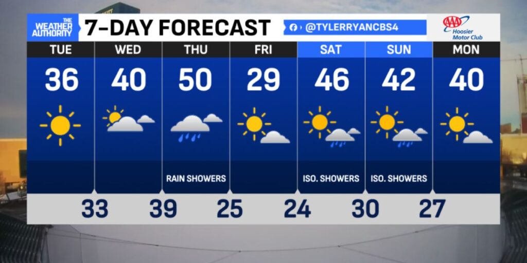
Starting Thursday, rain showers are expected to return to Central Indiana. Despite the precipitation, temperatures will continue to climb, with highs projected to exceed 50 degrees. Meteorologists note that the combination of warming temperatures and periodic rain may create rapidly changing conditions throughout the week, so residents should stay alert.
Planning Ahead
With temperatures swinging dramatically and periods of precipitation expected later in the week, experts advise residents to dress in layers, monitor forecasts, and be cautious on roadways, particularly during early morning commutes.
How are you preparing for the temperature swings and upcoming rain in Central Indiana? Share your tips and experiences with our community in the comments below.


