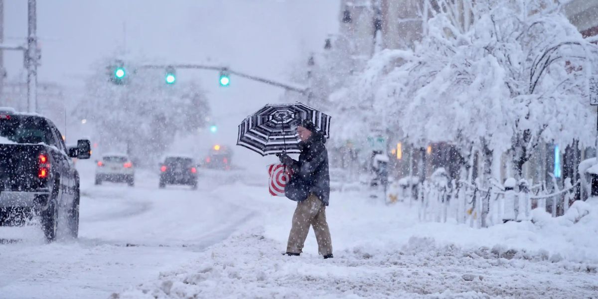
Trenton, NJ – Drivers in North-western New Jersey are being urged to use caution today as a combination of light snow and freezing rain creates slippery and potentially dangerous travel conditions. Forecasters are also monitoring the growing possibility of more widespread snowfall heading into the weekend.
Snow, Ice and Rain Set the Stage for a Treacherous Morning
According to early guidance from the National Weather Service (NWS) on Wednesday, the weather setup is split across the region. While most of New Jersey will see plain rain by late afternoon, parts of eastern Pennsylvania and northwestern New Jersey are expected to get snow and ice, particularly in areas close to I-78.
The agency noted there is still uncertainty for the I-78 corridor, depending on the speed at which the incoming precipitation arrives.
Precipitation will begin late this morning, initially falling as snow, before changing into a wintry mix. A short burst of freezing rain could create light icing, enough to make roads, sidewalks, and untreated surfaces hazardous.
Warmer South, Colder North: A Weather Divide Across New Jersey
While the northwest deals with frozen precipitation, the remainder of the state will see steady rainfall. Some northern counties could briefly experience a rain-snow mix, but accumulation is not expected.
Forecast highs for today include:
- Southern New Jersey: Mid to upper 40s
- Northern and Western regions: Upper 30s to low 40s
Conditions will gradually improve as precipitation tapers off this evening with the passage of a cold front.
Cold Front Ushers in Strong Winds and Frigid Nighttime Temperatures
Tonight, winds will shift to the west-northwest, increasing to 10–15 mph, with gusts reaching 25 mph. Overnight lows will plunge into the 20s inland and hover near 30° along the Jersey Shore.
By Thursday, the state will feel the full force of post-frontal cold air. Expect breezy conditions with gusts up to 35 mph, delivering wind chills in the teens and 20s. After sunset, wind chills will drop further into the single digits and lower teens.
North Jersey could pick up a few snow showers Thursday afternoon and evening.
Quiet Friday Before Another Unsettled Weekend Arrives
Friday will offer a brief lull in active weather. Conditions will stay cold, similar to Thursday, but winds will ease considerably.
The break will be short-lived. The NWS is tracking a developing system expected to bring light snow from Saturday night into Sunday morning. However, meteorologists note significant uncertainty regarding the storm’s exact track and intensity.
Temperatures remain below average on Saturday, before tumbling even more sharply on Sunday, enhancing the possibility of wintry weather.
Is All Snow Likely? Forecasters Say Not So Fast
According to AccuWeather Senior Storm Warning Meteorologist Eddie Walker, the timing of the coldest Arctic air will be crucial. Because the coldest air may arrive slightly later near the Atlantic coast, it is not guaranteed that the entire I-95 corridor will see all snow this weekend.
This reinforces uncertainty, especially for areas closer to central and southern New Jersey, where small temperature differences could mean rain, snow, or a mix.
Arctic High Pressure to Bring Brutal Cold Early Next Week
An incoming Arctic high-pressure system will dominate on Monday and Tuesday, delivering well-below-average temperatures across New Jersey. Monday, in particular, is expected to be harsh, with stronger breezes amplifying the chill.
The NWS also mentioned that another clipper system may approach Monday night, potentially bringing additional light snow.
What’s Your Take, New Jersey?
How are you preparing for ice, snow, and the Arctic cold heading our way? Share your thoughts, local updates, and travel experiences in the comments below!


