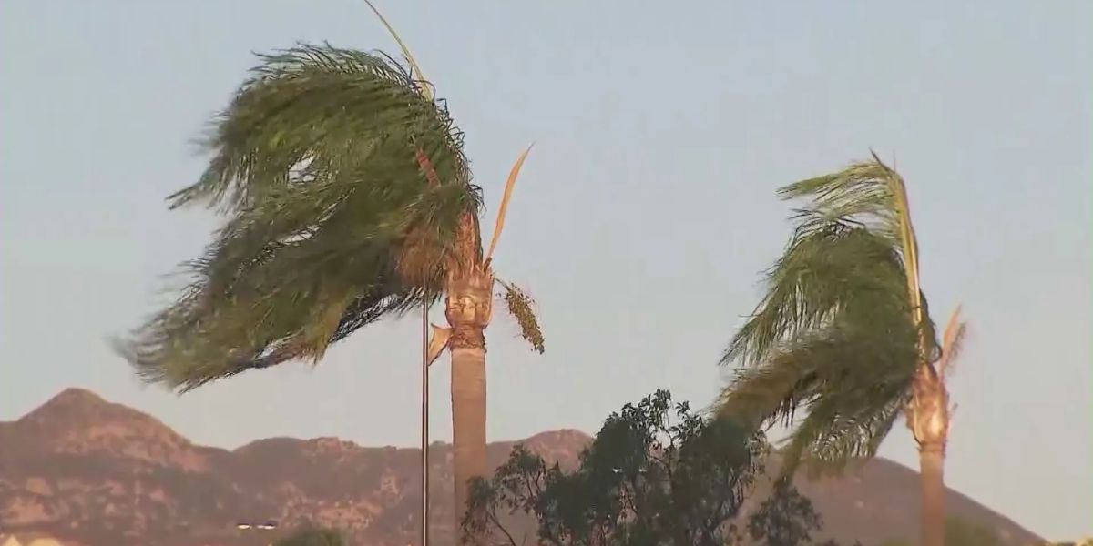
Los Angeles, CA — A powerful Santa Ana wind event pushed through Southern California on Thursday, bringing a mix of strong gusts, freezing temperatures, and hazardous conditions across multiple counties. Overnight video captured fierce winds sweeping through communities in the Inland Empire, including Ontario and Fontana, as trees swayed and debris scattered across roadways.
KTLA meteorologist Henry DiCarlo noted that this particular wind pattern is especially impactful for certain regions.
“When we get this particular Santa Ana setup — because they’re not all the same — we tend to get similar spots every time, and you know who you are,” DiCarlo said.
Wind Advisories Remain in Effect for Several Counties
The National Weather Service (NWS) has issued Wind Advisories through 3 p.m. Thursday for parts of Ventura and Los Angeles counties, including portions of the Santa Monica Mountains and the San Gabriel Mountains.

According to the NWS, northeast winds between 25 and 40 mph will continue throughout the day, with isolated gusts reaching up to 60 mph. These powerful gusts create conditions ripe for disruptions, hazards, and potential damage.
Potential Impacts Include:
- Localized downed trees and power outages
- Hazardous driving conditions caused by strong crosswinds and wind-blown debris
- Dangerous sea conditions, particularly nearshore, where gusts can create choppy waters
Residents across Southern California are urged to secure outdoor items, avoid parking under large trees, and take extra precautions while driving in impacted corridors.
Freezing Temperatures Grip Interior Regions
While wind remains the top concern, temperatures also plunged significantly across the region. The NWS reported that “cold conditions will bring freezing conditions to some areas each morning today and Friday,” with the coldest readings in the region’s far interior.
Freeze Warnings were in effect until 8 a.m. Thursday and will return overnight through Friday morning for interior regions, including the Antelope Valley, where freezing temperatures can pose risks to crops, pipes, and vulnerable residents.
Residents in freeze-prone areas are encouraged to take precautions such as covering plants, insulating exposed pipes, and ensuring outdoor pets have adequate shelter.
A Dramatic Warmup Expected Next Week
Despite the current cold and wind, meteorologists say a major warmup is on the horizon. According to KTLA’s Henry DiCarlo, next week’s temperatures are expected to soar, with afternoon highs reaching 10 to 20 degrees above normal for this time of year.
That means valley communities could see temperatures rising into the 80s, bringing a return to unseasonably warm weather. The National Weather Service even suggests “an outside shot of isolated 90 or 91 degree readings” in select locations if the warming trend intensifies.
This dramatic flip—from freezing mornings to near-summerlike afternoons—highlights the volatility of Southern California weather patterns during transitional months.
Preparing for Shifting Weather Conditions
With both gusty winds and freezing temperatures in play, emergency officials urge residents to remain alert.
Here are a few safety reminders:
- Avoid unnecessary driving in wind-prone areas.
- Secure patio furniture, umbrellas, and outdoor decorations.
- Keep phones charged in case of power outages.
- Check on elderly neighbors or those sensitive to cold conditions.
- Stay updated with NWS alerts as conditions evolve.
As the region moves into the weekend, meteorologists will continue to monitor shifting patterns and provide updates on temperature swings, wind intensity, and any potential hazards.
How Are the Santa Ana Winds Impacting You Today?
Have you experienced outages, debris, or freezing temps in your neighborhood? Share your experiences, photos, and safety tips in the comments below!


