Des Moines, Iowa — A powerful cold front is pushing through Iowa on Wednesday, ushering in a surge of northwest winds, falling temperatures, and periods of light snow, especially across northern parts of the state. Forecasters say temperatures will begin the day near 30°F, but the arrival of the cold front will send readings tumbling into the teens by late afternoon and evening.
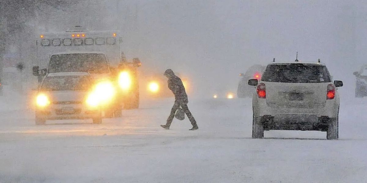
Meteorologists warn that the combination of gusty winds and rapidly falling temperatures will create hazardous travel conditions at times, especially on untreated roads where blowing snow could reduce visibility.
Light Snow Overnight in Northern Iowa
While the majority of the state will remain dry during the day, the light snow associated with the front will develop mainly in northern Iowa late Wednesday into early Thursday. Accumulation is expected to remain minor, but even light snow can create slick spots during the overnight hours.
Drivers traveling along northern routes are urged to use caution, particularly in rural areas where winds may cause patchy drifting.
First Subzero Morning of the Season Expected Thursday
Thursday morning will deliver a true blast of winter as air temperatures plunge below zero for the first time this season. In Des Moines, forecasters predict morning lows around -5°F, just one degree shy of the historic record low of -6°F, set on December 4, 1886.
The cold will be intensified by strong winds, which are expected to push wind chills down to -15°F or colder. At those levels, frostbite can occur on exposed skin in a relatively short amount of time.
Residents are encouraged to bundle up, check on vulnerable neighbors, and ensure pets are protected from the dangerous cold.
Another Round of Snow Possible This Weekend
Iowa won’t get much of a break. A developing storm system could bring additional snowfall from Saturday night into early Sunday morning. Current projections suggest 2 to 4 inches of snow are possible if the storm stays on its expected track.
Forecasters say confidence is growing in this system but note that subtle shifts in the storm path could affect snow totals across the state. Travelers planning weekend trips should monitor updates as the storm approaches.
More Snow Chances Early Next Week
The weather pattern remains active, with another chance for snow on Monday morning. While this system appears weaker, it could still create slippery travel conditions for the start of the workweek.
Meteorologists emphasize that none of the upcoming snow systems currently look like major winter storms, but the frequent rounds of precipitation—combined with bitter cold—will make for occasionally challenging driving conditions.
Driving Conditions Could Be Impacted
With temperatures consistently below freezing over the next several days, any snow that falls will likely stick quickly to roadways. Slick spots, reduced visibility, and wind-driven snowdrifts could impact travel at times, especially in open and rural parts of the state.
Officials advise drivers to:
- Reduce speed during snow events
- Keep extra distance between vehicles
- Carry winter survival kits
- Check weather updates regularly
What Do You Think?
Are you ready for Iowa’s first stretch of dangerous cold and multiple rounds of snow? Share your thoughts in the comments — how are you preparing for the winter blast?


