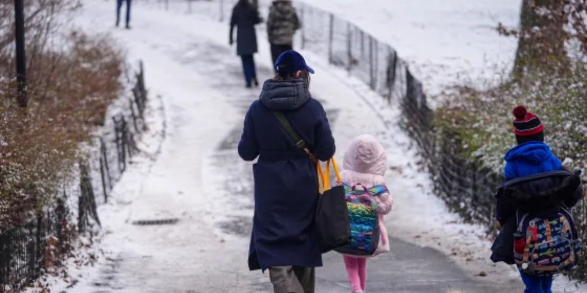
Green Bay, Wisc. — As Tuesday wraps up, residents across Green Bay are beginning to see light flurries, signaling the start of a frigid weather pattern. Overnight temperatures are expected to fall into the upper teens, setting the stage for a cold but manageable midweek warm-up.
Wednesday: Morning Snow, Afternoon Clearing, Bitter Night Ahead
By Wednesday, highs will reach the upper 20s, with light snow expected during the morning hours. Meteorologists predict skies will clear by the afternoon, bringing some calm before the real cold sets in.
Overnight, temperatures are forecast to plunge into the negative range, creating dangerous conditions heading into a brutally cold Thursday.
Thursday: Subzero Wind Chills Expected
Thursday will be the coldest day of the week. Even though daytime highs may rise into the mid-teens, strong winds are expected to drag wind chills down into the negative mid-teens. Forecasters warn residents to limit outdoor exposure, dress in insulated layers, and be cautious of frostbite risks.
Friday: A Slight Warm-Up and Possible Flurries
By Friday, temperatures show a modest improvement, climbing into the lower to mid-20s. While it’s warmer compared to the deep freeze earlier in the week, forecasters say there is still a slight chance of flurries, especially during the early morning hours.
Weekend Outlook: Partly Cloudy and Consistently Cold
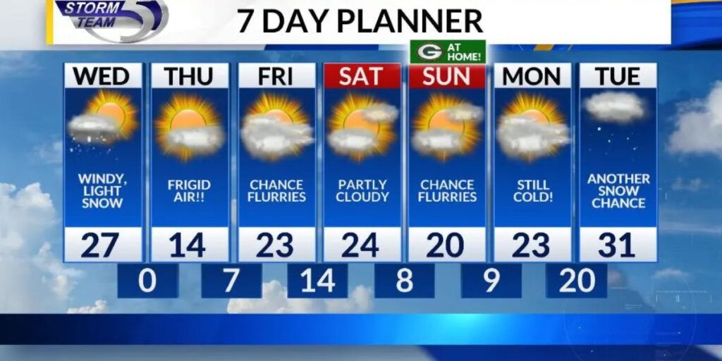
The weekend will bring a mix of calm skies and continued cold. Both Saturday and Sunday are expected to be partly cloudy, with temperatures hovering in the lower to mid-20s. No major precipitation is expected, offering a relatively stable but chilly weekend.
Next Week: Slow Warm-Up and Potential Snow on Tuesday
As the new week begins, Monday is forecast to stay cold, with temperatures in the lower 20s and mostly cloudy conditions. By Tuesday, temperatures may climb closer to the lower 30s, bringing the next chance for snow.
Meteorologists emphasize that snowfall predictions for Tuesday are still evolving as forecast models continue to update, and they encourage residents to stay alert for changes.
How are you preparing for the subzero wind chills and upcoming snow chances? Share your thoughts and tips in the comments below!


